MAJO Matsushiro, Japan - Earthquake Result Viewer
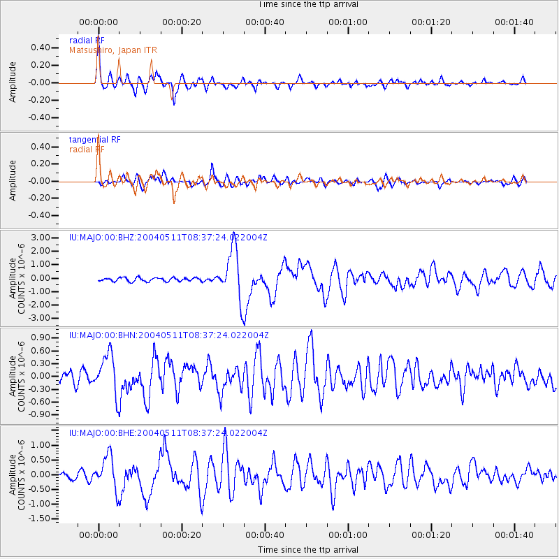
Earthquake location: Northern Sumatra, Indonesia
Earthquake latitude/longitude: 0.4/97.8
Earthquake time(UTC): 2004/05/11 (132) 08:28:48 GMT
Earthquake Depth: 21 km
Earthquake Magnitude: 5.6 MB, 6.2 MS, 6.1 MW, 6.1 MW
Earthquake Catalog/Contributor: WHDF/NEIC
Network: IU Global Seismograph Network (GSN - IRIS/USGS)
Station: MAJO Matsushiro, Japan
Lat/Lon: 36.54 N/138.21 E
Elevation: 405 m
Distance: 51.9 deg
Az: 41.564 deg
Baz: 235.469 deg
Ray Param: 0.06711297
Estimated Moho Depth: 28.75 km
Estimated Crust Vp/Vs: 2.10
Assumed Crust Vp: 6.461 km/s
Estimated Crust Vs: 3.084 km/s
Estimated Crust Poisson's Ratio: 0.35
Radial Match: 89.56284 %
Radial Bump: 400
Transverse Match: 70.7231 %
Transverse Bump: 400
SOD ConfigId: 2459
Insert Time: 2010-03-04 16:04:19.075 +0000
GWidth: 2.5
Max Bumps: 400
Tol: 0.001

Signal To Noise

ChannelStoNSTALTA
IU:MAJO:00:BHN:20040511T08:37:24.022004Z3.99338364.970649E-71.2447212E-7
IU:MAJO:00:BHE:20040511T08:37:24.022004Z4.35521175.957798E-71.3679698E-7
IU:MAJO:00:BHZ:20040511T08:37:24.022004Z14.7970981.9719369E-61.332651E-7
Arrivals
Ps5.1 SECOND
PpPs13 SECOND
PsPs/PpSs18 SECOND