MAJO Matsushiro, Japan - Earthquake Result Viewer
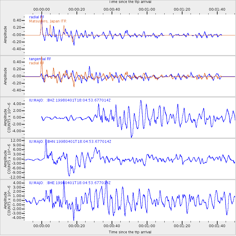
Earthquake location: Southern Sumatra, Indonesia
Earthquake latitude/longitude: -0.5/99.3
Earthquake time(UTC): 1998/04/01 (091) 17:56:23 GMT
Earthquake Depth: 56 km
Earthquake Magnitude: 6.2 MB, 6.9 MS, 7.0 UNKNOWN, 6.6 ME
Earthquake Catalog/Contributor: WHDF/NEIC
Network: IU Global Seismograph Network (GSN - IRIS/USGS)
Station: MAJO Matsushiro, Japan
Lat/Lon: 36.54 N/138.21 E
Elevation: 405 m
Distance: 51.6 deg
Az: 40.215 deg
Baz: 233.293 deg
Ray Param: 0.067136265
Estimated Moho Depth: 32.5 km
Estimated Crust Vp/Vs: 1.89
Assumed Crust Vp: 6.461 km/s
Estimated Crust Vs: 3.41 km/s
Estimated Crust Poisson's Ratio: 0.31
Radial Match: 89.32547 %
Radial Bump: 400
Transverse Match: 78.56564 %
Transverse Bump: 400
SOD ConfigId: 4480
Insert Time: 2010-03-04 16:04:30.863 +0000
GWidth: 2.5
Max Bumps: 400
Tol: 0.001

Signal To Noise

ChannelStoNSTALTA
IU:MAJO: :BHN:19980401T18:04:53.677014Z9.0029024.4062526E-64.8942576E-7
IU:MAJO: :BHE:19980401T18:04:53.677014Z2.27554259.842406E-74.3253007E-7
IU:MAJO: :BHZ:19980401T18:04:53.677014Z4.5461731.4701616E-63.2338443E-7
Arrivals
Ps4.7 SECOND
PpPs14 SECOND
PsPs/PpSs19 SECOND