You are here: Home > Network List > UW - Pacific Northwest Regional Seismic Network Stations List
> Station LEBA Lebam, WA, USA > Earthquake Result Viewer
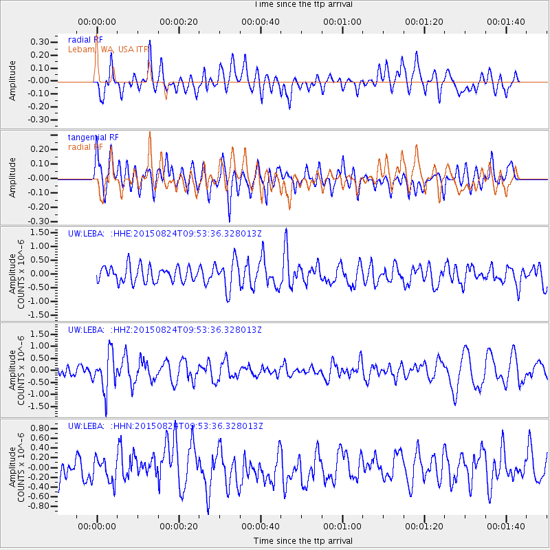
LEBA Lebam, WA, USA - Earthquake Result Viewer
*The percent match for this event was below the threshold and hence no stack was calculated.
| Earthquake location: |
Kermadec Islands Region |
| Earthquake latitude/longitude: |
-30.6/-179.1 |
| Earthquake time(UTC): |
2015/08/24 (236) 09:41:25 GMT |
| Earthquake Depth: |
224 km |
| Earthquake Magnitude: |
6.0 MW |
| Earthquake Catalog/Contributor: |
ISC/ISC |
|
| Network: |
UW Pacific Northwest Regional Seismic Network |
| Station: |
LEBA Lebam, WA, USA |
| Lat/Lon: |
46.55 N/123.56 W |
| Elevation: |
73 m |
|
| Distance: |
91.7 deg |
| Az: |
34.702 deg |
| Baz: |
225.304 deg |
| Ray Param: |
$rayparam |
*The percent match for this event was below the threshold and hence was not used in the summary stack. |
|
| Radial Match: |
47.600376 % |
| Radial Bump: |
400 |
| Transverse Match: |
66.3512 % |
| Transverse Bump: |
400 |
| SOD ConfigId: |
7422571 |
| Insert Time: |
2019-04-20 13:48:17.013 +0000 |
| GWidth: |
2.5 |
| Max Bumps: |
400 |
| Tol: |
0.001 |
|
Signal To Noise
| Channel | StoN | STA | LTA |
| UW:LEBA: :HHZ:20150824T09:53:36.328013Z | 3.0012383 | 7.911055E-7 | 2.6359302E-7 |
| UW:LEBA: :HHN:20150824T09:53:36.328013Z | 0.94457734 | 2.5851378E-7 | 2.7368196E-7 |
| UW:LEBA: :HHE:20150824T09:53:36.328013Z | 1.9693027 | 5.4573E-7 | 2.771184E-7 |
| Arrivals |
| Ps | |
| PpPs | |
| PsPs/PpSs | |


