
GSC Goldstone, California, USA - Earthquake Result Viewer
| ||||||||||||||||||
| ||||||||||||||||||
| ||||||||||||||||||
|
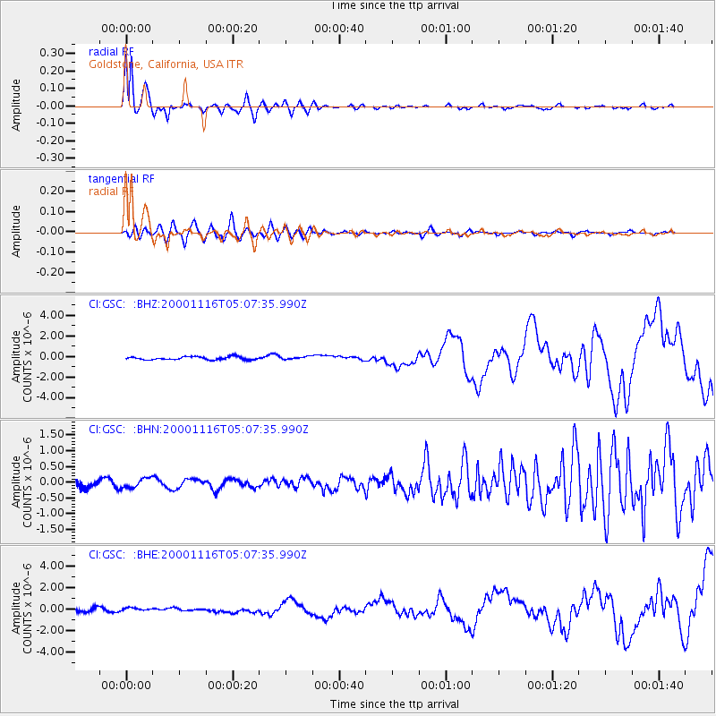
Signal To Noise
| Channel | StoN | STA | LTA |
| CI:GSC: :BHN:20001116T05:07:35.990Z | 1.0288897 | 1.52656E-7 | 1.4836964E-7 |
| CI:GSC: :BHE:20001116T05:07:35.990Z | 0.6471119 | 1.388668E-7 | 2.1459472E-7 |
| CI:GSC: :BHZ:20001116T05:07:35.990Z | 0.8844482 | 1.3387798E-7 | 1.5136894E-7 |
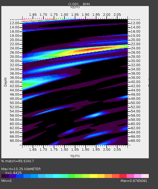
| Arrivals | |
| Ps | 1.1 SECOND |
| PpPs | 4.2 SECOND |
| PsPs/PpSs | 5.3 SECOND |

