MAJO Matsushiro, Japan - Earthquake Result Viewer
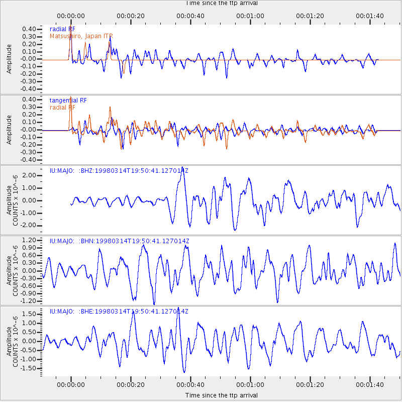
Earthquake location: Northern And Central Iran
Earthquake latitude/longitude: 30.2/57.6
Earthquake time(UTC): 1998/03/14 (073) 19:40:27 GMT
Earthquake Depth: 9.0 km
Earthquake Magnitude: 5.9 MB, 6.9 MS, 6.6 UNKNOWN, 6.3 ME
Earthquake Catalog/Contributor: WHDF/NEIC
Network: IU Global Seismograph Network (GSN - IRIS/USGS)
Station: MAJO Matsushiro, Japan
Lat/Lon: 36.54 N/138.21 E
Elevation: 405 m
Distance: 65.8 deg
Az: 60.596 deg
Baz: 290.451 deg
Ray Param: 0.058047608
Estimated Moho Depth: 52.5 km
Estimated Crust Vp/Vs: 1.73
Assumed Crust Vp: 6.461 km/s
Estimated Crust Vs: 3.73 km/s
Estimated Crust Poisson's Ratio: 0.25
Radial Match: 92.83672 %
Radial Bump: 327
Transverse Match: 70.882164 %
Transverse Bump: 400
SOD ConfigId: 6273
Insert Time: 2010-03-04 16:05:07.497 +0000
GWidth: 2.5
Max Bumps: 400
Tol: 0.001

Signal To Noise

ChannelStoNSTALTA
IU:MAJO: :BHN:19980314T19:50:41.127014Z0.581474661.5920376E-72.7379315E-7
IU:MAJO: :BHE:19980314T19:50:41.127014Z1.16240082.3481223E-72.0200625E-7
IU:MAJO: :BHZ:19980314T19:50:41.127014Z3.46167377.9793745E-72.3050626E-7
Arrivals
Ps6.2 SECOND
PpPs21 SECOND
PsPs/PpSs27 SECOND