You are here: Home > Network List > UW - Pacific Northwest Regional Seismic Network Stations List
> Station LEBA Lebam, WA, USA > Earthquake Result Viewer
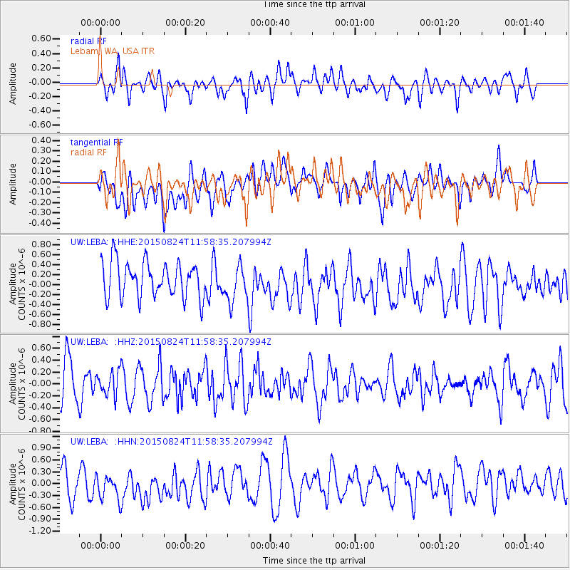
LEBA Lebam, WA, USA - Earthquake Result Viewer
*The percent match for this event was below the threshold and hence no stack was calculated.
| Earthquake location: |
Komandorskiye Ostrova Region |
| Earthquake latitude/longitude: |
56.2/164.3 |
| Earthquake time(UTC): |
2015/08/24 (236) 11:50:59 GMT |
| Earthquake Depth: |
23 km |
| Earthquake Magnitude: |
5.5 MW |
| Earthquake Catalog/Contributor: |
ISC/ISC |
|
| Network: |
UW Pacific Northwest Regional Seismic Network |
| Station: |
LEBA Lebam, WA, USA |
| Lat/Lon: |
46.55 N/123.56 W |
| Elevation: |
73 m |
|
| Distance: |
44.1 deg |
| Az: |
70.811 deg |
| Baz: |
310.096 deg |
| Ray Param: |
$rayparam |
*The percent match for this event was below the threshold and hence was not used in the summary stack. |
|
| Radial Match: |
62.967983 % |
| Radial Bump: |
400 |
| Transverse Match: |
53.39031 % |
| Transverse Bump: |
400 |
| SOD ConfigId: |
7422571 |
| Insert Time: |
2019-04-20 13:57:44.626 +0000 |
| GWidth: |
2.5 |
| Max Bumps: |
400 |
| Tol: |
0.001 |
|
Signal To Noise
| Channel | StoN | STA | LTA |
| UW:LEBA: :HHZ:20150824T11:58:35.207994Z | 0.6324077 | 2.0498186E-7 | 3.2412927E-7 |
| UW:LEBA: :HHN:20150824T11:58:35.207994Z | 1.3324776 | 4.1024515E-7 | 3.0788146E-7 |
| UW:LEBA: :HHE:20150824T11:58:35.207994Z | 1.0519997 | 3.7254935E-7 | 3.5413447E-7 |
| Arrivals |
| Ps | |
| PpPs | |
| PsPs/PpSs | |


