MAJO Matsushiro, Japan - Earthquake Result Viewer
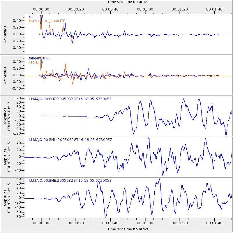
Earthquake location: Northern Sumatra, Indonesia
Earthquake latitude/longitude: 2.1/97.1
Earthquake time(UTC): 2005/03/28 (087) 16:09:36 GMT
Earthquake Depth: 30 km
Earthquake Magnitude: 7.2 MB, 8.4 MS, 8.7 MW, 8.1 MW
Earthquake Catalog/Contributor: WHDF/NEIC
Network: IU Global Seismograph Network (GSN - IRIS/USGS)
Station: MAJO Matsushiro, Japan
Lat/Lon: 36.54 N/138.21 E
Elevation: 405 m
Distance: 51.1 deg
Az: 42.859 deg
Baz: 237.572 deg
Ray Param: 0.06757067
Estimated Moho Depth: 33.5 km
Estimated Crust Vp/Vs: 1.82
Assumed Crust Vp: 6.461 km/s
Estimated Crust Vs: 3.545 km/s
Estimated Crust Poisson's Ratio: 0.28
Radial Match: 97.1758 %
Radial Bump: 346
Transverse Match: 89.5947 %
Transverse Bump: 400
SOD ConfigId: 2459
Insert Time: 2010-03-04 16:05:36.185 +0000
GWidth: 2.5
Max Bumps: 400
Tol: 0.001

Signal To Noise

ChannelStoNSTALTA
IU:MAJO:00:BHN:20050328T16:18:05.673005Z4.7697362.1154485E-64.4351484E-7
IU:MAJO:00:BHE:20050328T16:18:05.673005Z5.6788492.7742053E-64.885154E-7
IU:MAJO:00:BHZ:20050328T16:18:05.673005Z4.12280236.11604E-61.4834666E-6
Arrivals
Ps4.5 SECOND
PpPs14 SECOND
PsPs/PpSs18 SECOND