You are here: Home > Network List > UW - Pacific Northwest Regional Seismic Network Stations List
> Station PASS Maple Falls, WA, USA > Earthquake Result Viewer
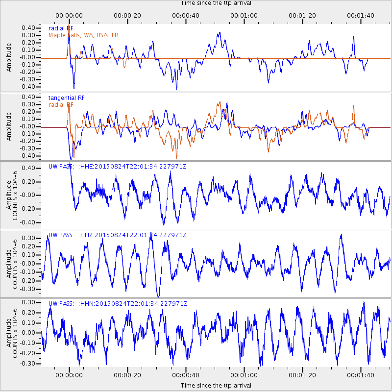
PASS Maple Falls, WA, USA - Earthquake Result Viewer
*The percent match for this event was below the threshold and hence no stack was calculated.
| Earthquake location: |
Fiji Islands Region |
| Earthquake latitude/longitude: |
-17.9/-178.5 |
| Earthquake time(UTC): |
2015/08/24 (236) 21:50:39 GMT |
| Earthquake Depth: |
590 km |
| Earthquake Magnitude: |
4.5 mb |
| Earthquake Catalog/Contributor: |
ISC/ISC |
|
| Network: |
UW Pacific Northwest Regional Seismic Network |
| Station: |
PASS Maple Falls, WA, USA |
| Lat/Lon: |
49.00 N/122.09 W |
| Elevation: |
174 m |
|
| Distance: |
83.3 deg |
| Az: |
33.546 deg |
| Baz: |
233.045 deg |
| Ray Param: |
$rayparam |
*The percent match for this event was below the threshold and hence was not used in the summary stack. |
|
| Radial Match: |
56.03401 % |
| Radial Bump: |
400 |
| Transverse Match: |
61.84572 % |
| Transverse Bump: |
400 |
| SOD ConfigId: |
7422571 |
| Insert Time: |
2019-04-20 14:04:33.996 +0000 |
| GWidth: |
2.5 |
| Max Bumps: |
400 |
| Tol: |
0.001 |
|
Signal To Noise
| Channel | StoN | STA | LTA |
| UW:PASS: :HHZ:20150824T22:01:34.227971Z | 0.72428304 | 1.0489964E-7 | 1.4483238E-7 |
| UW:PASS: :HHN:20150824T22:01:34.227971Z | 1.2857509 | 1.9081945E-7 | 1.484109E-7 |
| UW:PASS: :HHE:20150824T22:01:34.227971Z | 1.7913202 | 2.5311218E-7 | 1.4129922E-7 |
| Arrivals |
| Ps | |
| PpPs | |
| PsPs/PpSs | |


