MAJO Matsushiro, Japan - Earthquake Result Viewer
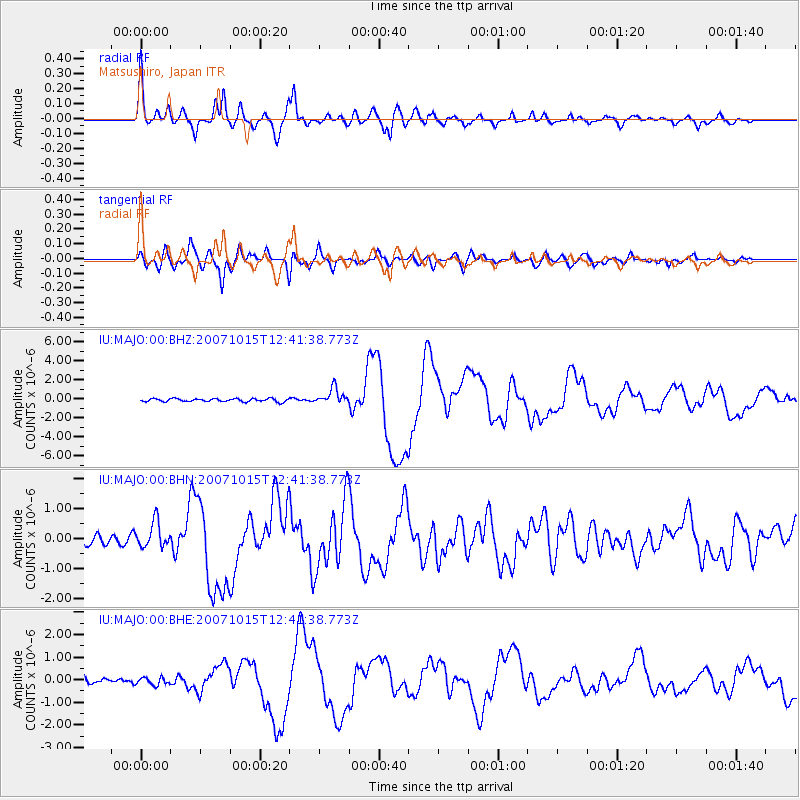
Earthquake location: South Island, New Zealand
Earthquake latitude/longitude: -44.8/167.6
Earthquake time(UTC): 2007/10/15 (288) 12:29:36 GMT
Earthquake Depth: 26 km
Earthquake Magnitude: 6.0 MB, 6.8 MS, 6.8 MW, 6.7 MW
Earthquake Catalog/Contributor: WHDF/NEIC
Network: IU Global Seismograph Network (GSN - IRIS/USGS)
Station: MAJO Matsushiro, Japan
Lat/Lon: 36.54 N/138.21 E
Elevation: 405 m
Distance: 85.2 deg
Az: 336.645 deg
Baz: 159.479 deg
Ray Param: 0.044900723
Estimated Moho Depth: 31.5 km
Estimated Crust Vp/Vs: 1.91
Assumed Crust Vp: 6.461 km/s
Estimated Crust Vs: 3.379 km/s
Estimated Crust Poisson's Ratio: 0.31
Radial Match: 95.74524 %
Radial Bump: 400
Transverse Match: 94.027664 %
Transverse Bump: 400
SOD ConfigId: 2564
Insert Time: 2010-03-04 16:06:25.613 +0000
GWidth: 2.5
Max Bumps: 400
Tol: 0.001

Signal To Noise

ChannelStoNSTALTA
IU:MAJO:00:BHN:20071015T12:41:38.773Z2.65098714.3439027E-71.6385982E-7
IU:MAJO:00:BHE:20071015T12:41:38.773Z1.52978311.6487203E-71.07774774E-7
IU:MAJO:00:BHZ:20071015T12:41:38.773Z5.12347278.1968307E-71.5998583E-7
Arrivals
Ps4.6 SECOND
PpPs14 SECOND
PsPs/PpSs18 SECOND