MAJO Matsushiro, Japan - Earthquake Result Viewer
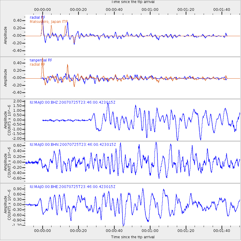
Earthquake location: Nicobar Islands, India Region
Earthquake latitude/longitude: 7.2/92.5
Earthquake time(UTC): 2007/07/25 (206) 23:37:31 GMT
Earthquake Depth: 15 km
Earthquake Magnitude: 5.5 MB, 6.1 MS, 6.1 MW, 6.0 MW
Earthquake Catalog/Contributor: WHDF/NEIC
Network: IU Global Seismograph Network (GSN - IRIS/USGS)
Station: MAJO Matsushiro, Japan
Lat/Lon: 36.54 N/138.21 E
Elevation: 405 m
Distance: 50.8 deg
Az: 48.012 deg
Baz: 246.329 deg
Ray Param: 0.0677809
Estimated Moho Depth: 37.5 km
Estimated Crust Vp/Vs: 1.60
Assumed Crust Vp: 6.461 km/s
Estimated Crust Vs: 4.038 km/s
Estimated Crust Poisson's Ratio: 0.18
Radial Match: 92.25043 %
Radial Bump: 337
Transverse Match: 85.18974 %
Transverse Bump: 400
SOD ConfigId: 2564
Insert Time: 2010-03-04 16:06:42.829 +0000
GWidth: 2.5
Max Bumps: 400
Tol: 0.001

Signal To Noise

ChannelStoNSTALTA
IU:MAJO:00:BHN:20070725T23:46:00.423015Z3.99101881.6347714E-74.0961254E-8
IU:MAJO:00:BHE:20070725T23:46:00.423015Z13.3100413.316248E-72.4915385E-8
IU:MAJO:00:BHZ:20070725T23:46:00.423015Z20.0698157.826504E-73.8996394E-8
Arrivals
Ps3.7 SECOND
PpPs14 SECOND
PsPs/PpSs18 SECOND