MAJO Matsushiro, Japan - Earthquake Result Viewer
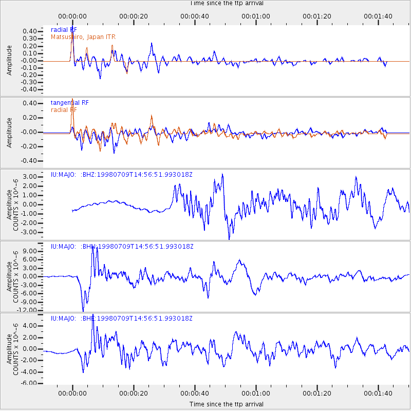
Earthquake location: Kermadec Islands, New Zealand
Earthquake latitude/longitude: -30.5/-179.0
Earthquake time(UTC): 1998/07/09 (190) 14:45:39 GMT
Earthquake Depth: 130 km
Earthquake Magnitude: 6.2 MB, 6.2 MS, 6.9 UNKNOWN, 6.4 ME
Earthquake Catalog/Contributor: WHDF/NEIC
Network: IU Global Seismograph Network (GSN - IRIS/USGS)
Station: MAJO Matsushiro, Japan
Lat/Lon: 36.54 N/138.21 E
Elevation: 405 m
Distance: 77.8 deg
Az: 325.963 deg
Baz: 143.131 deg
Ray Param: 0.04974372
Estimated Moho Depth: 29.5 km
Estimated Crust Vp/Vs: 1.97
Assumed Crust Vp: 6.461 km/s
Estimated Crust Vs: 3.276 km/s
Estimated Crust Poisson's Ratio: 0.33
Radial Match: 94.40102 %
Radial Bump: 400
Transverse Match: 82.45737 %
Transverse Bump: 400
SOD ConfigId: 4480
Insert Time: 2010-03-04 16:07:01.203 +0000
GWidth: 2.5
Max Bumps: 400
Tol: 0.001

Signal To Noise

ChannelStoNSTALTA
IU:MAJO: :BHN:19980709T14:56:51.993018Z37.178245.1437974E-61.3835503E-7
IU:MAJO: :BHE:19980709T14:56:51.993018Z4.41000841.5506477E-63.5162012E-7
IU:MAJO: :BHZ:19980709T14:56:51.993018Z2.8519459.424133E-73.3044583E-7
Arrivals
Ps4.6 SECOND
PpPs13 SECOND
PsPs/PpSs18 SECOND