You are here: Home > Network List > TA - USArray Transportable Network (new EarthScope stations) Stations List
> Station O03E Paynes Creek, CA, USA > Earthquake Result Viewer
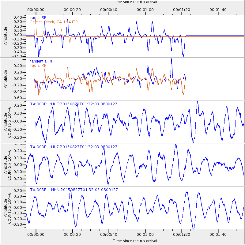
O03E Paynes Creek, CA, USA - Earthquake Result Viewer
*The percent match for this event was below the threshold and hence no stack was calculated.
| Earthquake location: |
Vanuatu Islands Region |
| Earthquake latitude/longitude: |
-21.5/173.4 |
| Earthquake time(UTC): |
2015/08/27 (239) 01:19:52 GMT |
| Earthquake Depth: |
0.0 km |
| Earthquake Magnitude: |
4.2 mb |
| Earthquake Catalog/Contributor: |
ISC/ISC |
|
| Network: |
TA USArray Transportable Network (new EarthScope stations) |
| Station: |
O03E Paynes Creek, CA, USA |
| Lat/Lon: |
40.29 N/121.80 W |
| Elevation: |
967 m |
|
| Distance: |
86.0 deg |
| Az: |
43.914 deg |
| Baz: |
237.643 deg |
| Ray Param: |
$rayparam |
*The percent match for this event was below the threshold and hence was not used in the summary stack. |
|
| Radial Match: |
68.06245 % |
| Radial Bump: |
400 |
| Transverse Match: |
71.46977 % |
| Transverse Bump: |
400 |
| SOD ConfigId: |
7422571 |
| Insert Time: |
2019-04-20 14:21:07.478 +0000 |
| GWidth: |
2.5 |
| Max Bumps: |
400 |
| Tol: |
0.001 |
|
Signal To Noise
| Channel | StoN | STA | LTA |
| TA:O03E: :HHZ:20150827T01:32:03.080012Z | 0.95773035 | 1.326982E-7 | 1.3855487E-7 |
| TA:O03E: :HHN:20150827T01:32:03.080012Z | 0.7295213 | 1.5229118E-7 | 2.0875497E-7 |
| TA:O03E: :HHE:20150827T01:32:03.080012Z | 0.62041456 | 7.458724E-8 | 1.2022163E-7 |
| Arrivals |
| Ps | |
| PpPs | |
| PsPs/PpSs | |


