MAJO Matsushiro, Japan - Earthquake Result Viewer
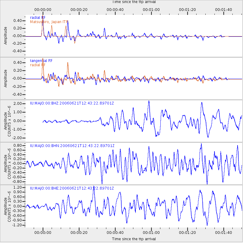
Earthquake location: Nicobar Islands, India Region
Earthquake latitude/longitude: 6.9/92.5
Earthquake time(UTC): 2006/06/21 (172) 12:34:52 GMT
Earthquake Depth: 16 km
Earthquake Magnitude: 5.7 MB, 5.7 MS, 5.9 MW, 5.9 MW
Earthquake Catalog/Contributor: WHDF/NEIC
Network: IU Global Seismograph Network (GSN - IRIS/USGS)
Station: MAJO Matsushiro, Japan
Lat/Lon: 36.54 N/138.21 E
Elevation: 405 m
Distance: 51.0 deg
Az: 47.907 deg
Baz: 246.175 deg
Ray Param: 0.06765826
Estimated Moho Depth: 37.0 km
Estimated Crust Vp/Vs: 1.62
Assumed Crust Vp: 6.461 km/s
Estimated Crust Vs: 4.001 km/s
Estimated Crust Poisson's Ratio: 0.19
Radial Match: 90.99171 %
Radial Bump: 342
Transverse Match: 82.97082 %
Transverse Bump: 400
SOD ConfigId: 5423
Insert Time: 2010-03-04 16:08:46.828 +0000
GWidth: 2.5
Max Bumps: 400
Tol: 0.001

Signal To Noise

ChannelStoNSTALTA
IU:MAJO:00:BHN:20060621T12:43:22.89701Z1.07314487.1848426E-86.695129E-8
IU:MAJO:00:BHE:20060621T12:43:22.89701Z1.44565861.1515987E-77.96591E-8
IU:MAJO:00:BHZ:20060621T12:43:22.89701Z3.6455153.0193945E-78.282491E-8
Arrivals
Ps3.8 SECOND
PpPs14 SECOND
PsPs/PpSs18 SECOND