You are here: Home > Network List > IU - Global Seismograph Network (GSN - IRIS/USGS) Stations List
> Station MAJO Matsushiro, Japan > Earthquake Result Viewer
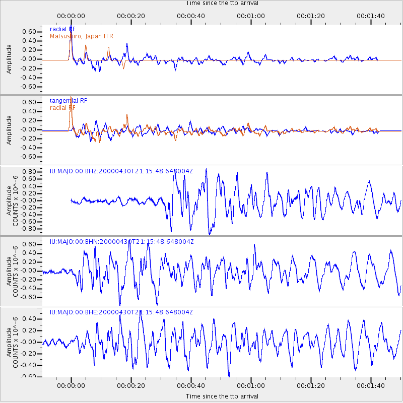
MAJO Matsushiro, Japan - Earthquake Result Viewer

| Earthquake location: |
Bismarck Sea |
| Earthquake latitude/longitude: |
-4.0/146.6 |
| Earthquake time(UTC): |
2000/04/30 (121) 21:08:35 GMT |
| Earthquake Depth: |
10 km |
| Earthquake Magnitude: |
5.3 MB, 5.7 MS, 5.9 MW, 5.9 MW |
| Earthquake Catalog/Contributor: |
WHDF/NEIC |
|
| Network: |
IU Global Seismograph Network (GSN - IRIS/USGS) |
| Station: |
MAJO Matsushiro, Japan |
| Lat/Lon: |
36.54 N/138.21 E |
| Elevation: |
405 m |
|
| Distance: |
41.1 deg |
| Az: |
349.747 deg |
| Baz: |
167.262 deg |
| Ray Param: |
0.07402449 |
| Estimated Moho Depth: |
50.0 km |
| Estimated Crust Vp/Vs: |
1.62 |
| Assumed Crust Vp: |
6.461 km/s |
| Estimated Crust Vs: |
3.995 km/s |
| Estimated Crust Poisson's Ratio: |
0.19 |
|
| Radial Match: |
91.64207 % |
| Radial Bump: |
400 |
| Transverse Match: |
87.71002 % |
| Transverse Bump: |
400 |
| SOD ConfigId: |
3753 |
| Insert Time: |
2010-03-04 16:09:19.125 +0000 |
| GWidth: |
2.5 |
| Max Bumps: |
400 |
| Tol: |
0.001 |
|
Signal To Noise
| Channel | StoN | STA | LTA |
| IU:MAJO:00:BHN:20000430T21:15:48.648004Z | 3.6789398 | 2.2669522E-7 | 6.161971E-8 |
| IU:MAJO:00:BHE:20000430T21:15:48.648004Z | 1.7997223 | 7.6342545E-8 | 4.241907E-8 |
| IU:MAJO:00:BHZ:20000430T21:15:48.648004Z | 7.8016596 | 4.2275914E-7 | 5.418836E-8 |
| Arrivals |
| Ps | 5.2 SECOND |
| PpPs | 19 SECOND |
| PsPs/PpSs | 24 SECOND |


