You are here: Home > Network List > GS - US Geological Survey Networks Stations List
> Station KAN10 Keim Farm > Earthquake Result Viewer
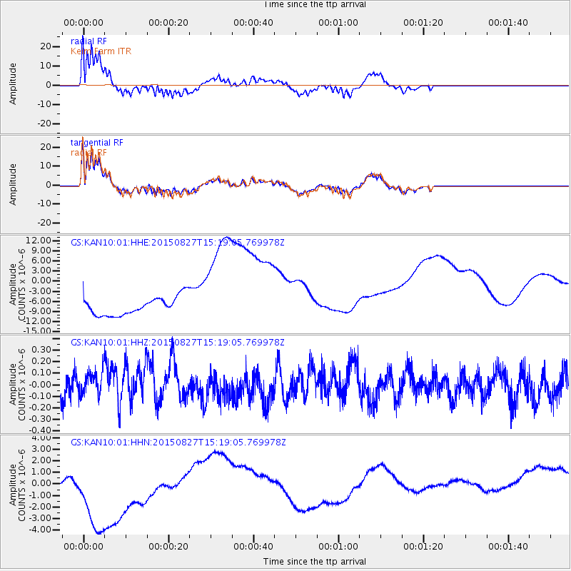
KAN10 Keim Farm - Earthquake Result Viewer
*The percent match for this event was below the threshold and hence no stack was calculated.
| Earthquake location: |
Fiji Islands Region |
| Earthquake latitude/longitude: |
-19.8/-176.3 |
| Earthquake time(UTC): |
2015/08/27 (239) 15:06:25 GMT |
| Earthquake Depth: |
12 km |
| Earthquake Magnitude: |
5.4 MW |
| Earthquake Catalog/Contributor: |
ISC/ISC |
|
| Network: |
GS US Geological Survey Networks |
| Station: |
KAN10 Keim Farm |
| Lat/Lon: |
37.12 N/98.10 W |
| Elevation: |
417 m |
|
| Distance: |
92.8 deg |
| Az: |
51.558 deg |
| Baz: |
247.308 deg |
| Ray Param: |
$rayparam |
*The percent match for this event was below the threshold and hence was not used in the summary stack. |
|
| Radial Match: |
75.61535 % |
| Radial Bump: |
400 |
| Transverse Match: |
74.75001 % |
| Transverse Bump: |
400 |
| SOD ConfigId: |
7422571 |
| Insert Time: |
2019-04-20 14:40:21.516 +0000 |
| GWidth: |
2.5 |
| Max Bumps: |
400 |
| Tol: |
0.001 |
|
Signal To Noise
| Channel | StoN | STA | LTA |
| GS:KAN10:01:HHZ:20150827T15:19:05.769978Z | 0.673337 | 1.17663475E-7 | 1.7474679E-7 |
| GS:KAN10:01:HHN:20150827T15:19:05.769978Z | 4.384314 | 5.1542975E-6 | 1.1756224E-6 |
| GS:KAN10:01:HHE:20150827T15:19:05.769978Z | 6.3563213 | 1.6763692E-5 | 2.6373261E-6 |
| Arrivals |
| Ps | |
| PpPs | |
| PsPs/PpSs | |


