You are here: Home > Network List > US - United States National Seismic Network Stations List
> Station EGMT Eagleton, Montana, USA > Earthquake Result Viewer
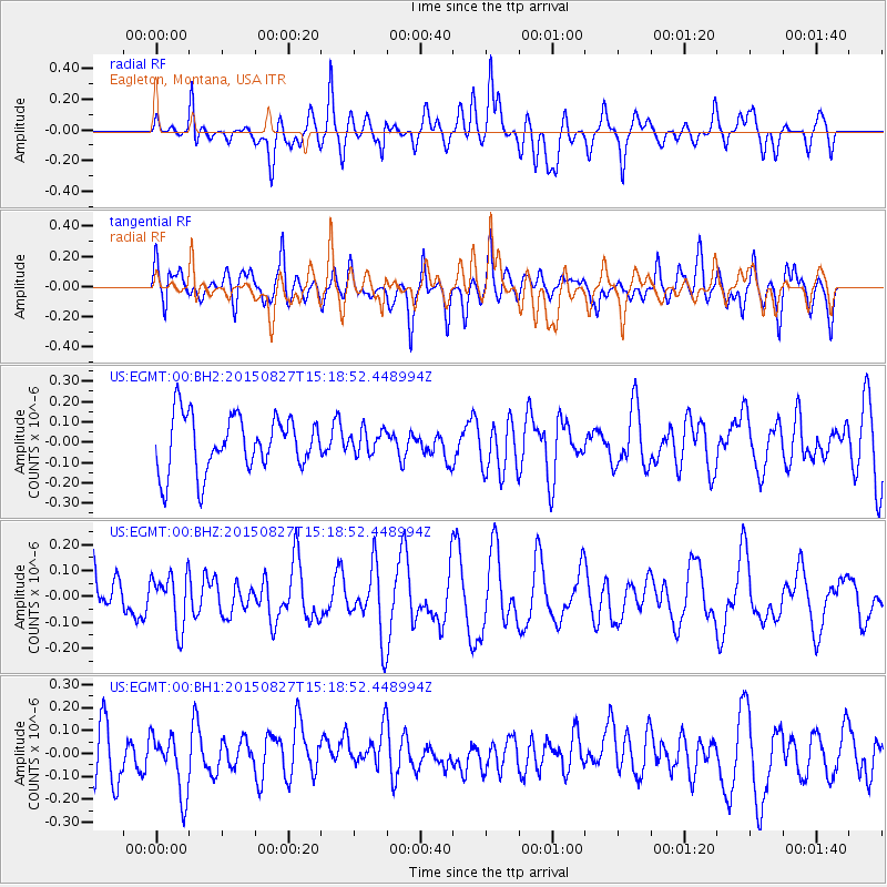
EGMT Eagleton, Montana, USA - Earthquake Result Viewer
*The percent match for this event was below the threshold and hence no stack was calculated.
| Earthquake location: |
Fiji Islands Region |
| Earthquake latitude/longitude: |
-19.8/-176.3 |
| Earthquake time(UTC): |
2015/08/27 (239) 15:06:25 GMT |
| Earthquake Depth: |
12 km |
| Earthquake Magnitude: |
5.4 MW |
| Earthquake Catalog/Contributor: |
ISC/ISC |
|
| Network: |
US United States National Seismic Network |
| Station: |
EGMT Eagleton, Montana, USA |
| Lat/Lon: |
48.02 N/109.75 W |
| Elevation: |
1055 m |
|
| Distance: |
89.9 deg |
| Az: |
38.003 deg |
| Baz: |
239.713 deg |
| Ray Param: |
$rayparam |
*The percent match for this event was below the threshold and hence was not used in the summary stack. |
|
| Radial Match: |
55.585754 % |
| Radial Bump: |
400 |
| Transverse Match: |
59.134914 % |
| Transverse Bump: |
400 |
| SOD ConfigId: |
7422571 |
| Insert Time: |
2019-04-20 14:43:05.501 +0000 |
| GWidth: |
2.5 |
| Max Bumps: |
400 |
| Tol: |
0.001 |
|
Signal To Noise
| Channel | StoN | STA | LTA |
| US:EGMT:00:BHZ:20150827T15:18:52.448994Z | 1.2598864 | 1.0156301E-7 | 8.061283E-8 |
| US:EGMT:00:BH1:20150827T15:18:52.448994Z | 1.1322215 | 1.3874052E-7 | 1.2253832E-7 |
| US:EGMT:00:BH2:20150827T15:18:52.448994Z | 0.42507976 | 5.7664316E-8 | 1.3565528E-7 |
| Arrivals |
| Ps | |
| PpPs | |
| PsPs/PpSs | |


