You are here: Home > Network List > US - United States National Seismic Network Stations List
> Station WMOK Wichita Mountains, Oklahoma, USA > Earthquake Result Viewer
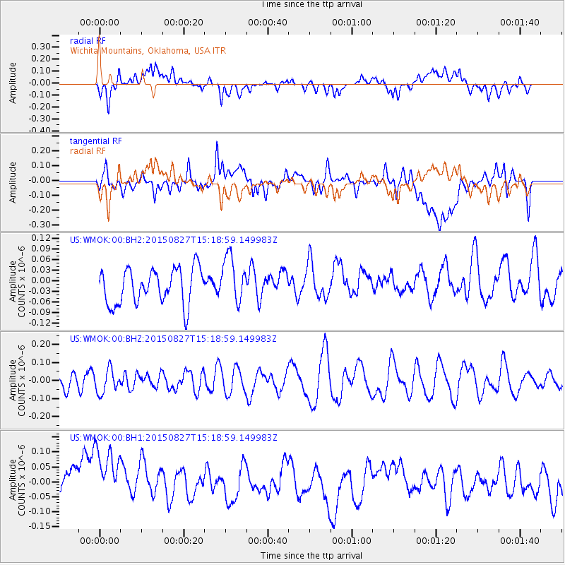
WMOK Wichita Mountains, Oklahoma, USA - Earthquake Result Viewer
*The percent match for this event was below the threshold and hence no stack was calculated.
| Earthquake location: |
Fiji Islands Region |
| Earthquake latitude/longitude: |
-19.8/-176.3 |
| Earthquake time(UTC): |
2015/08/27 (239) 15:06:25 GMT |
| Earthquake Depth: |
12 km |
| Earthquake Magnitude: |
5.4 MW |
| Earthquake Catalog/Contributor: |
ISC/ISC |
|
| Network: |
US United States National Seismic Network |
| Station: |
WMOK Wichita Mountains, Oklahoma, USA |
| Lat/Lon: |
34.74 N/98.78 W |
| Elevation: |
486 m |
|
| Distance: |
91.3 deg |
| Az: |
53.535 deg |
| Baz: |
246.836 deg |
| Ray Param: |
$rayparam |
*The percent match for this event was below the threshold and hence was not used in the summary stack. |
|
| Radial Match: |
36.238247 % |
| Radial Bump: |
400 |
| Transverse Match: |
32.312737 % |
| Transverse Bump: |
400 |
| SOD ConfigId: |
7422571 |
| Insert Time: |
2019-04-20 14:43:11.053 +0000 |
| GWidth: |
2.5 |
| Max Bumps: |
400 |
| Tol: |
0.001 |
|
Signal To Noise
| Channel | StoN | STA | LTA |
| US:WMOK:00:BHZ:20150827T15:18:59.149983Z | 0.8434003 | 6.6965534E-8 | 7.939947E-8 |
| US:WMOK:00:BH1:20150827T15:18:59.149983Z | 2.152681 | 1.5090875E-7 | 7.010269E-8 |
| US:WMOK:00:BH2:20150827T15:18:59.149983Z | 1.3399862 | 6.7067475E-8 | 5.005087E-8 |
| Arrivals |
| Ps | |
| PpPs | |
| PsPs/PpSs | |


