
MAJO Matsushiro, Japan - Earthquake Result Viewer
| ||||||||||||||||||
| ||||||||||||||||||
| ||||||||||||||||||
|
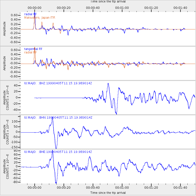
Signal To Noise
| Channel | StoN | STA | LTA |
| IU:MAJO: :BHN:19990405T11:15:19.989014Z | 5.2439075 | 3.808052E-6 | 7.26186E-7 |
| IU:MAJO: :BHE:19990405T11:15:19.989014Z | 4.90755 | 2.3009886E-6 | 4.688671E-7 |
| IU:MAJO: :BHZ:19990405T11:15:19.989014Z | 4.83916 | 7.121009E-7 | 1.4715383E-7 |
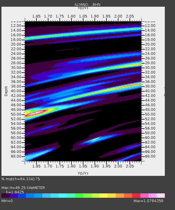
| Arrivals | |
| Ps | 5.3 SECOND |
| PpPs | 19 SECOND |
| PsPs/PpSs | 24 SECOND |

