
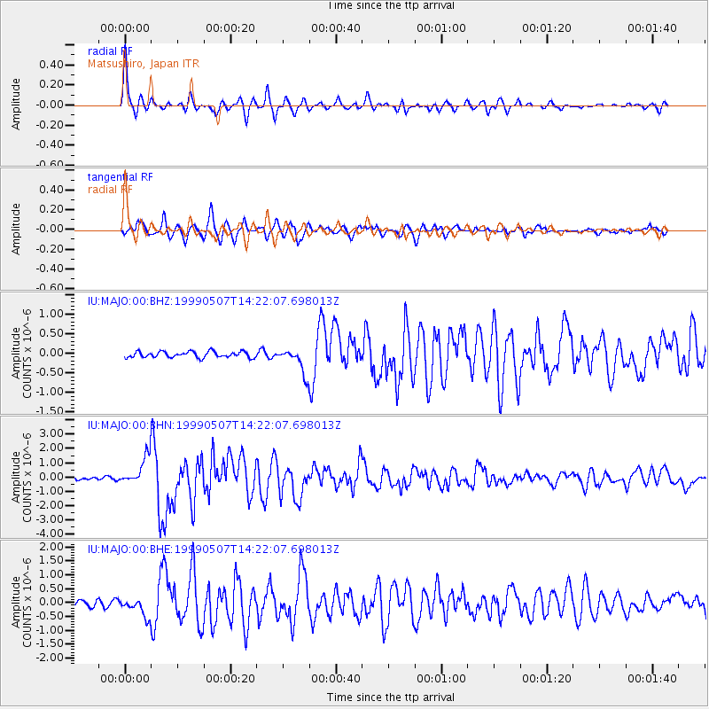
MAJO Matsushiro, Japan - Earthquake Result Viewer
| ||||||||||||||||||
| ||||||||||||||||||
| ||||||||||||||||||
|
Signal To Noise
| Channel | StoN | STA | LTA |
| IU:MAJO:00:BHN:19990507T14:22:07.698013Z | 10.838108 | 9.971584E-7 | 9.200483E-8 |
| IU:MAJO:00:BHE:19990507T14:22:07.698013Z | 2.6128561 | 3.3120835E-7 | 1.2676104E-7 |
| IU:MAJO:00:BHZ:19990507T14:22:07.698013Z | 4.233718 | 3.2375362E-7 | 7.647029E-8 |
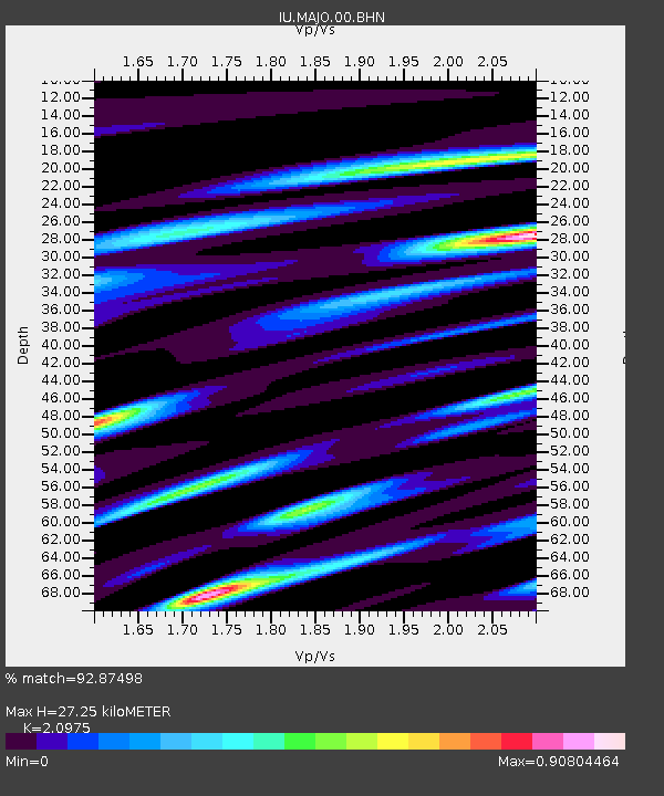
| Arrivals | |
| Ps | 4.9 SECOND |
| PpPs | 12 SECOND |
| PsPs/PpSs | 17 SECOND |

