MAJO Matsushiro, Japan - Earthquake Result Viewer
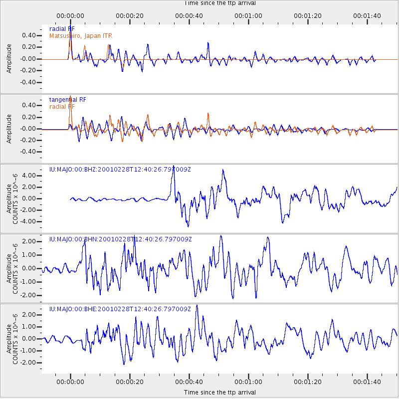
Earthquake location: Southeast Of Loyalty Islands
Earthquake latitude/longitude: -22.0/170.2
Earthquake time(UTC): 2001/02/28 (059) 12:30:14 GMT
Earthquake Depth: 10 km
Earthquake Magnitude: 6.0 MB, 6.5 MS, 6.7 MW, 6.5 MW
Earthquake Catalog/Contributor: WHDF/NEIC
Network: IU Global Seismograph Network (GSN - IRIS/USGS)
Station: MAJO Matsushiro, Japan
Lat/Lon: 36.54 N/138.21 E
Elevation: 405 m
Distance: 65.6 deg
Az: 332.054 deg
Baz: 147.309 deg
Ray Param: 0.058169965
Estimated Moho Depth: 47.0 km
Estimated Crust Vp/Vs: 1.71
Assumed Crust Vp: 6.461 km/s
Estimated Crust Vs: 3.79 km/s
Estimated Crust Poisson's Ratio: 0.24
Radial Match: 92.02404 %
Radial Bump: 400
Transverse Match: 79.47896 %
Transverse Bump: 400
SOD ConfigId: 3744
Insert Time: 2010-03-04 16:11:06.285 +0000
GWidth: 2.5
Max Bumps: 400
Tol: 0.001

Signal To Noise

ChannelStoNSTALTA
IU:MAJO:00:BHN:20010228T12:40:26.797009Z4.88825567.792284E-71.5940826E-7
IU:MAJO:00:BHE:20010228T12:40:26.797009Z1.75708733.3159182E-71.8871675E-7
IU:MAJO:00:BHZ:20010228T12:40:26.797009Z10.4340491.8909271E-61.812266E-7
Arrivals
Ps5.4 SECOND
PpPs19 SECOND
PsPs/PpSs24 SECOND