You are here: Home > Network List > TA - USArray Transportable Network (new EarthScope stations) Stations List
> Station 121A Cookes Peak, Deming, NM, USA > Earthquake Result Viewer
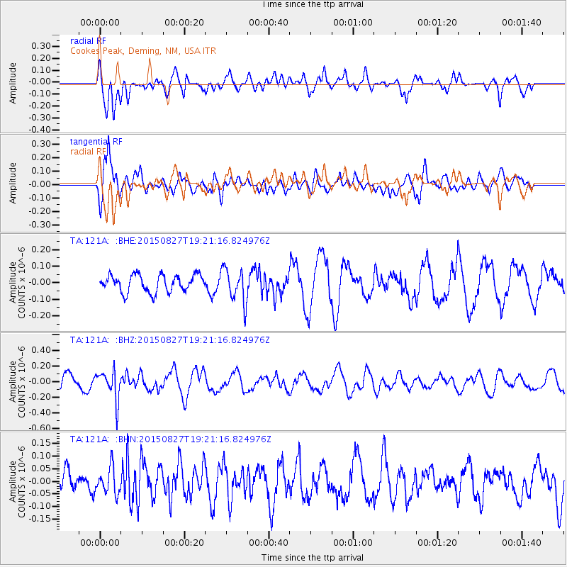
121A Cookes Peak, Deming, NM, USA - Earthquake Result Viewer
*The percent match for this event was below the threshold and hence no stack was calculated.
| Earthquake location: |
Kuril Islands |
| Earthquake latitude/longitude: |
45.1/147.3 |
| Earthquake time(UTC): |
2015/08/27 (239) 19:10:10 GMT |
| Earthquake Depth: |
146 km |
| Earthquake Magnitude: |
5.1 MW |
| Earthquake Catalog/Contributor: |
ISC/ISC |
|
| Network: |
TA USArray Transportable Network (new EarthScope stations) |
| Station: |
121A Cookes Peak, Deming, NM, USA |
| Lat/Lon: |
32.53 N/107.79 W |
| Elevation: |
1652 m |
|
| Distance: |
77.1 deg |
| Az: |
56.856 deg |
| Baz: |
315.378 deg |
| Ray Param: |
$rayparam |
*The percent match for this event was below the threshold and hence was not used in the summary stack. |
|
| Radial Match: |
49.72804 % |
| Radial Bump: |
400 |
| Transverse Match: |
65.888176 % |
| Transverse Bump: |
400 |
| SOD ConfigId: |
7422571 |
| Insert Time: |
2019-04-20 14:54:50.892 +0000 |
| GWidth: |
2.5 |
| Max Bumps: |
400 |
| Tol: |
0.001 |
|
Signal To Noise
| Channel | StoN | STA | LTA |
| TA:121A: :BHZ:20150827T19:21:16.824976Z | 3.0554469 | 1.9198565E-7 | 6.2833905E-8 |
| TA:121A: :BHN:20150827T19:21:16.824976Z | 0.89177626 | 5.3794086E-8 | 6.03224E-8 |
| TA:121A: :BHE:20150827T19:21:16.824976Z | 2.0225756 | 1.03223655E-7 | 5.1035748E-8 |
| Arrivals |
| Ps | |
| PpPs | |
| PsPs/PpSs | |


