You are here: Home > Network List > IU - Global Seismograph Network (GSN - IRIS/USGS) Stations List
> Station MAJO Matsushiro, Japan > Earthquake Result Viewer
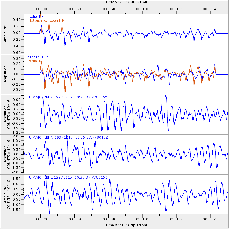
MAJO Matsushiro, Japan - Earthquake Result Viewer
*The percent match for this event was below the threshold and hence no stack was calculated.
| Earthquake location: |
New Britain Region, P.N.G. |
| Earthquake latitude/longitude: |
-6.0/149.9 |
| Earthquake time(UTC): |
1997/12/15 (349) 10:28:06 GMT |
| Earthquake Depth: |
33 km |
| Earthquake Magnitude: |
5.8 MS, 5.3 MB, 5.9 UNKNOWN, 5.9 MW |
| Earthquake Catalog/Contributor: |
WHDF/NEIC |
|
| Network: |
IU Global Seismograph Network (GSN - IRIS/USGS) |
| Station: |
MAJO Matsushiro, Japan |
| Lat/Lon: |
36.54 N/138.21 E |
| Elevation: |
405 m |
|
| Distance: |
43.7 deg |
| Az: |
346.387 deg |
| Baz: |
163.102 deg |
| Ray Param: |
$rayparam |
*The percent match for this event was below the threshold and hence was not used in the summary stack. |
|
| Radial Match: |
60.588234 % |
| Radial Bump: |
400 |
| Transverse Match: |
53.300014 % |
| Transverse Bump: |
400 |
| SOD ConfigId: |
4480 |
| Insert Time: |
2010-03-04 16:11:49.269 +0000 |
| GWidth: |
2.5 |
| Max Bumps: |
400 |
| Tol: |
0.001 |
|
Signal To Noise
| Channel | StoN | STA | LTA |
| IU:MAJO: :BHN:19971215T10:35:37.778015Z | 1.6538141 | 6.31342E-7 | 3.817491E-7 |
| IU:MAJO: :BHE:19971215T10:35:37.778015Z | 2.5646274 | 8.6383E-7 | 3.3682474E-7 |
| IU:MAJO: :BHZ:19971215T10:35:37.778015Z | 0.93394685 | 3.644159E-7 | 3.9018911E-7 |
| Arrivals |
| Ps | |
| PpPs | |
| PsPs/PpSs | |


