You are here: Home > Network List > US - United States National Seismic Network Stations List
> Station MSO Missoula, Montana, USA > Earthquake Result Viewer
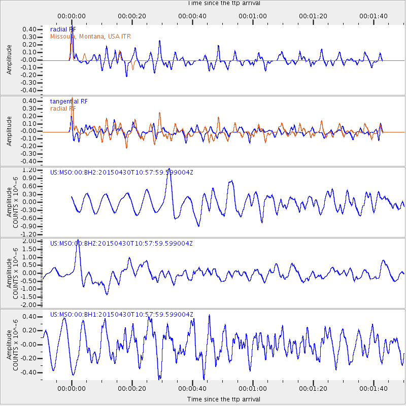
MSO Missoula, Montana, USA - Earthquake Result Viewer
*The percent match for this event was below the threshold and hence no stack was calculated.
| Earthquake location: |
New Britain Region, P.N.G. |
| Earthquake latitude/longitude: |
-5.5/151.8 |
| Earthquake time(UTC): |
2015/04/30 (120) 10:45:06 GMT |
| Earthquake Depth: |
60 km |
| Earthquake Magnitude: |
6.8 MWP, 6.8 MI |
| Earthquake Catalog/Contributor: |
NEIC PDE/NEIC COMCAT |
|
| Network: |
US United States National Seismic Network |
| Station: |
MSO Missoula, Montana, USA |
| Lat/Lon: |
46.83 N/113.94 W |
| Elevation: |
1264 m |
|
| Distance: |
96.8 deg |
| Az: |
43.603 deg |
| Baz: |
269.342 deg |
| Ray Param: |
$rayparam |
*The percent match for this event was below the threshold and hence was not used in the summary stack. |
|
| Radial Match: |
78.87602 % |
| Radial Bump: |
400 |
| Transverse Match: |
73.42461 % |
| Transverse Bump: |
400 |
| SOD ConfigId: |
872571 |
| Insert Time: |
2015-05-14 11:14:42.992 +0000 |
| GWidth: |
2.5 |
| Max Bumps: |
400 |
| Tol: |
0.001 |
|
Signal To Noise
| Channel | StoN | STA | LTA |
| US:MSO:00:BHZ:20150430T10:57:59.599004Z | 3.0523477 | 9.800021E-7 | 3.2106504E-7 |
| US:MSO:00:BH1:20150430T10:57:59.599004Z | 1.3192383 | 2.7142684E-7 | 2.0574512E-7 |
| US:MSO:00:BH2:20150430T10:57:59.599004Z | 2.5106766 | 6.592661E-7 | 2.6258502E-7 |
| Arrivals |
| Ps | |
| PpPs | |
| PsPs/PpSs | |


