You are here: Home > Network List > US - United States National Seismic Network Stations List
> Station MIAR Mount Ida, Arkansas, USA > Earthquake Result Viewer
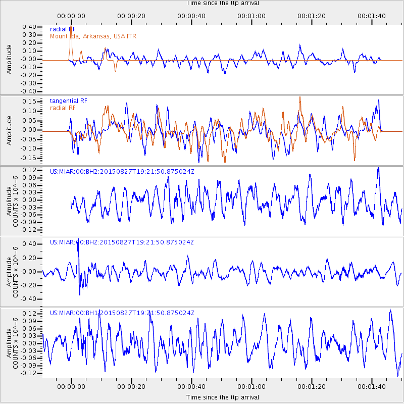
MIAR Mount Ida, Arkansas, USA - Earthquake Result Viewer
*The percent match for this event was below the threshold and hence no stack was calculated.
| Earthquake location: |
Kuril Islands |
| Earthquake latitude/longitude: |
45.1/147.3 |
| Earthquake time(UTC): |
2015/08/27 (239) 19:10:10 GMT |
| Earthquake Depth: |
146 km |
| Earthquake Magnitude: |
5.1 MW |
| Earthquake Catalog/Contributor: |
ISC/ISC |
|
| Network: |
US United States National Seismic Network |
| Station: |
MIAR Mount Ida, Arkansas, USA |
| Lat/Lon: |
34.55 N/93.58 W |
| Elevation: |
207 m |
|
| Distance: |
83.5 deg |
| Az: |
46.517 deg |
| Baz: |
321.47 deg |
| Ray Param: |
$rayparam |
*The percent match for this event was below the threshold and hence was not used in the summary stack. |
|
| Radial Match: |
50.170174 % |
| Radial Bump: |
400 |
| Transverse Match: |
46.276867 % |
| Transverse Bump: |
400 |
| SOD ConfigId: |
7422571 |
| Insert Time: |
2019-04-20 14:56:11.531 +0000 |
| GWidth: |
2.5 |
| Max Bumps: |
400 |
| Tol: |
0.001 |
|
Signal To Noise
| Channel | StoN | STA | LTA |
| US:MIAR:00:BHZ:20150827T19:21:50.875024Z | 3.739846 | 1.8061051E-7 | 4.8293572E-8 |
| US:MIAR:00:BH1:20150827T19:21:50.875024Z | 1.1649102 | 5.4180305E-8 | 4.6510287E-8 |
| US:MIAR:00:BH2:20150827T19:21:50.875024Z | 1.5685822 | 5.7283795E-8 | 3.6519474E-8 |
| Arrivals |
| Ps | |
| PpPs | |
| PsPs/PpSs | |


