You are here: Home > Network List > IU - Global Seismograph Network (GSN - IRIS/USGS) Stations List
> Station MAJO Matsushiro, Japan > Earthquake Result Viewer
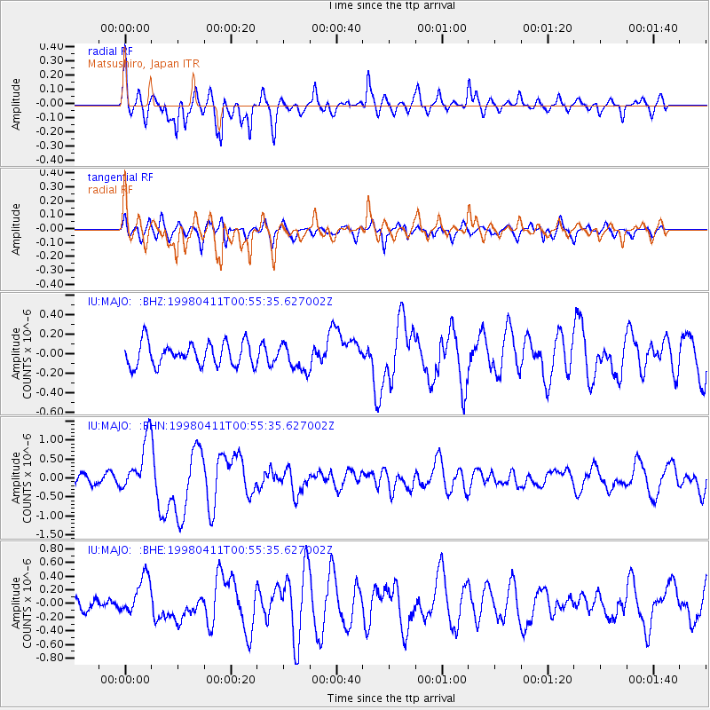
MAJO Matsushiro, Japan - Earthquake Result Viewer
*The percent match for this event was below the threshold and hence no stack was calculated.
| Earthquake location: |
South Of Fiji Islands |
| Earthquake latitude/longitude: |
-23.6/-176.1 |
| Earthquake time(UTC): |
1998/04/11 (101) 00:44:35 GMT |
| Earthquake Depth: |
33 km |
| Earthquake Magnitude: |
5.7 MB, 6.1 MS, 6.2 UNKNOWN, 6.1 MW |
| Earthquake Catalog/Contributor: |
WHDF/NEIC |
|
| Network: |
IU Global Seismograph Network (GSN - IRIS/USGS) |
| Station: |
MAJO Matsushiro, Japan |
| Lat/Lon: |
36.54 N/138.21 E |
| Elevation: |
405 m |
|
| Distance: |
73.8 deg |
| Az: |
323.121 deg |
| Baz: |
136.888 deg |
| Ray Param: |
$rayparam |
*The percent match for this event was below the threshold and hence was not used in the summary stack. |
|
| Radial Match: |
78.459305 % |
| Radial Bump: |
400 |
| Transverse Match: |
74.840775 % |
| Transverse Bump: |
400 |
| SOD ConfigId: |
4480 |
| Insert Time: |
2010-03-04 16:11:52.341 +0000 |
| GWidth: |
2.5 |
| Max Bumps: |
400 |
| Tol: |
0.001 |
|
Signal To Noise
| Channel | StoN | STA | LTA |
| IU:MAJO: :BHN:19980411T00:55:35.627002Z | 6.6896353 | 7.030035E-7 | 1.0508847E-7 |
| IU:MAJO: :BHE:19980411T00:55:35.627002Z | 2.9008696 | 2.835385E-7 | 9.7742586E-8 |
| IU:MAJO: :BHZ:19980411T00:55:35.627002Z | 1.1495125 | 1.353517E-7 | 1.1774704E-7 |
| Arrivals |
| Ps | |
| PpPs | |
| PsPs/PpSs | |


