You are here: Home > Network List > WY - Yellowstone Wyoming Seismic Network Stations List
> Station YHH Holmes Hill, YNP, WY, USA > Earthquake Result Viewer
YHH Holmes Hill, YNP, WY, USA - Earthquake Result Viewer
*The percent match for this event was below the threshold and hence no stack was calculated.
| Earthquake location: |
Kuril Islands |
| Earthquake latitude/longitude: |
45.1/147.3 |
| Earthquake time(UTC): |
2015/08/27 (239) 19:10:10 GMT |
| Earthquake Depth: |
146 km |
| Earthquake Magnitude: |
5.1 MW |
| Earthquake Catalog/Contributor: |
ISC/ISC |
|
| Network: |
WY Yellowstone Wyoming Seismic Network |
| Station: |
YHH Holmes Hill, YNP, WY, USA |
| Lat/Lon: |
44.79 N/110.85 W |
| Elevation: |
2717 m |
|
| Distance: |
67.0 deg |
| Az: |
49.226 deg |
| Baz: |
311.092 deg |
| Ray Param: |
$rayparam |
*The percent match for this event was below the threshold and hence was not used in the summary stack. |
|
| Radial Match: |
57.65381 % |
| Radial Bump: |
400 |
| Transverse Match: |
67.48717 % |
| Transverse Bump: |
400 |
| SOD ConfigId: |
7422571 |
| Insert Time: |
2019-04-20 14:56:52.873 +0000 |
| GWidth: |
2.5 |
| Max Bumps: |
400 |
| Tol: |
0.001 |
|
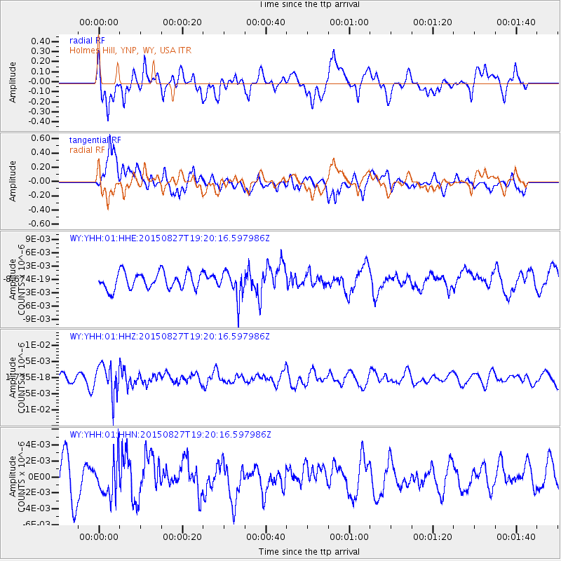
Signal To Noise
| Channel | StoN | STA | LTA |
| WY:YHH:01:HHZ:20150827T19:20:16.597986Z | 3.0724425 | 4.7410613E-9 | 1.5430919E-9 |
| WY:YHH:01:HHN:20150827T19:20:16.597986Z | 1.006182 | 2.356092E-9 | 2.341616E-9 |
| WY:YHH:01:HHE:20150827T19:20:16.597986Z | 1.6639147 | 3.0535818E-9 | 1.8351793E-9 |
| Arrivals |
| Ps | |
| PpPs | |
| PsPs/PpSs | |


