You are here: Home > Network List > IU - Global Seismograph Network (GSN - IRIS/USGS) Stations List
> Station MAJO Matsushiro, Japan > Earthquake Result Viewer
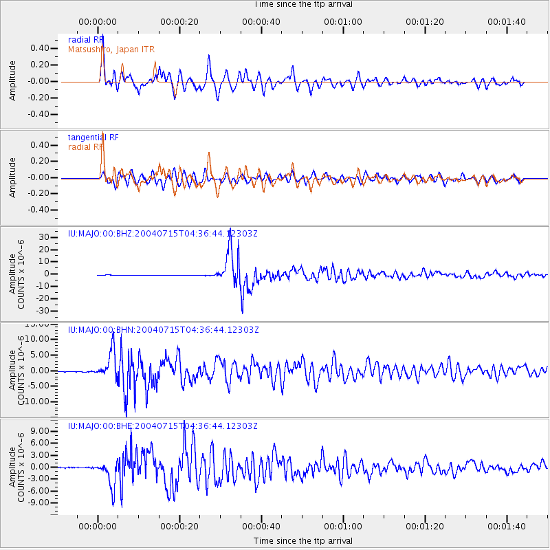
MAJO Matsushiro, Japan - Earthquake Result Viewer
*The percent match for this event was below the threshold and hence no stack was calculated.
| Earthquake location: |
Fiji Islands Region |
| Earthquake latitude/longitude: |
-17.6/-178.6 |
| Earthquake time(UTC): |
2004/07/15 (197) 04:27:12 GMT |
| Earthquake Depth: |
560 km |
| Earthquake Magnitude: |
5.5 MB |
| Earthquake Catalog/Contributor: |
WHDF/NEIC |
|
| Network: |
IU Global Seismograph Network (GSN - IRIS/USGS) |
| Station: |
MAJO Matsushiro, Japan |
| Lat/Lon: |
36.54 N/138.21 E |
| Elevation: |
405 m |
|
| Distance: |
67.6 deg |
| Az: |
323.409 deg |
| Baz: |
135.104 deg |
| Ray Param: |
$rayparam |
*The percent match for this event was below the threshold and hence was not used in the summary stack. |
|
| Radial Match: |
87.02981 % |
| Radial Bump: |
400 |
| Transverse Match: |
78.949486 % |
| Transverse Bump: |
400 |
| SOD ConfigId: |
2459 |
| Insert Time: |
2010-03-04 16:12:11.410 +0000 |
| GWidth: |
2.5 |
| Max Bumps: |
400 |
| Tol: |
0.001 |
|
Signal To Noise
| Channel | StoN | STA | LTA |
| IU:MAJO:00:BHN:20040715T04:36:44.12303Z | 63.987274 | 4.518899E-6 | 7.062184E-8 |
| IU:MAJO:00:BHE:20040715T04:36:44.12303Z | 46.333332 | 3.3448102E-6 | 7.2190154E-8 |
| IU:MAJO:00:BHZ:20040715T04:36:44.12303Z | 97.00537 | 1.3684876E-5 | 1.4107339E-7 |
| Arrivals |
| Ps | |
| PpPs | |
| PsPs/PpSs | |


