You are here: Home > Network List > IU - Global Seismograph Network (GSN - IRIS/USGS) Stations List
> Station MAJO Matsushiro, Japan > Earthquake Result Viewer
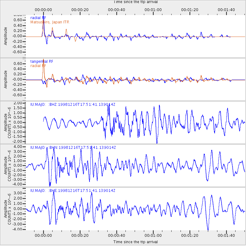
MAJO Matsushiro, Japan - Earthquake Result Viewer
*The percent match for this event was below the threshold and hence no stack was calculated.
| Earthquake location: |
Northern Molucca Sea |
| Earthquake latitude/longitude: |
1.1/126.2 |
| Earthquake time(UTC): |
1998/12/16 (350) 17:45:05 GMT |
| Earthquake Depth: |
33 km |
| Earthquake Magnitude: |
5.9 MB, 5.8 MS, 6.2 UNKNOWN, 6.0 MW |
| Earthquake Catalog/Contributor: |
WHDF/NEIC |
|
| Network: |
IU Global Seismograph Network (GSN - IRIS/USGS) |
| Station: |
MAJO Matsushiro, Japan |
| Lat/Lon: |
36.54 N/138.21 E |
| Elevation: |
405 m |
|
| Distance: |
37.0 deg |
| Az: |
16.211 deg |
| Baz: |
200.279 deg |
| Ray Param: |
$rayparam |
*The percent match for this event was below the threshold and hence was not used in the summary stack. |
|
| Radial Match: |
79.573845 % |
| Radial Bump: |
257 |
| Transverse Match: |
69.8168 % |
| Transverse Bump: |
400 |
| SOD ConfigId: |
4480 |
| Insert Time: |
2010-03-04 16:12:20.701 +0000 |
| GWidth: |
2.5 |
| Max Bumps: |
400 |
| Tol: |
0.001 |
|
Signal To Noise
| Channel | StoN | STA | LTA |
| IU:MAJO: :BHN:19981216T17:51:41.139014Z | 5.7180634 | 2.2105273E-6 | 3.865867E-7 |
| IU:MAJO: :BHE:19981216T17:51:41.139014Z | 4.2052402 | 1.2871297E-6 | 3.0607757E-7 |
| IU:MAJO: :BHZ:19981216T17:51:41.139014Z | 1.6182096 | 5.180363E-7 | 3.201293E-7 |
| Arrivals |
| Ps | |
| PpPs | |
| PsPs/PpSs | |


