You are here: Home > Network List > TA - USArray Transportable Network (new EarthScope stations) Stations List
> Station I23K Minto, Yukon-Koyukuk, AK, USA > Earthquake Result Viewer
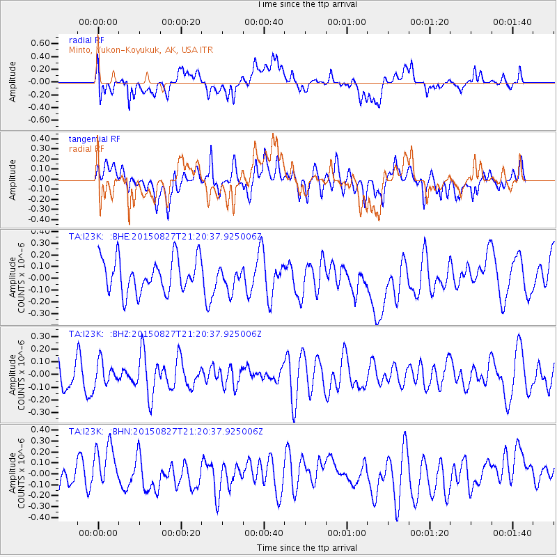
I23K Minto, Yukon-Koyukuk, AK, USA - Earthquake Result Viewer
*The percent match for this event was below the threshold and hence no stack was calculated.
| Earthquake location: |
Hokkaido, Japan Region |
| Earthquake latitude/longitude: |
42.4/142.6 |
| Earthquake time(UTC): |
2015/08/27 (239) 21:13:13 GMT |
| Earthquake Depth: |
77 km |
| Earthquake Magnitude: |
4.5 mb |
| Earthquake Catalog/Contributor: |
ISC/ISC |
|
| Network: |
TA USArray Transportable Network (new EarthScope stations) |
| Station: |
I23K Minto, Yukon-Koyukuk, AK, USA |
| Lat/Lon: |
65.15 N/149.36 W |
| Elevation: |
149 m |
|
| Distance: |
43.4 deg |
| Az: |
34.753 deg |
| Baz: |
272.726 deg |
| Ray Param: |
$rayparam |
*The percent match for this event was below the threshold and hence was not used in the summary stack. |
|
| Radial Match: |
48.667397 % |
| Radial Bump: |
400 |
| Transverse Match: |
40.230682 % |
| Transverse Bump: |
400 |
| SOD ConfigId: |
7422571 |
| Insert Time: |
2019-04-20 15:04:43.607 +0000 |
| GWidth: |
2.5 |
| Max Bumps: |
400 |
| Tol: |
0.001 |
|
Signal To Noise
| Channel | StoN | STA | LTA |
| TA:I23K: :BHZ:20150827T21:20:37.925006Z | 0.7621333 | 8.917843E-8 | 1.1701158E-7 |
| TA:I23K: :BHN:20150827T21:20:37.925006Z | 2.0042531 | 2.250732E-7 | 1.1229779E-7 |
| TA:I23K: :BHE:20150827T21:20:37.925006Z | 0.6749013 | 9.728752E-8 | 1.4415073E-7 |
| Arrivals |
| Ps | |
| PpPs | |
| PsPs/PpSs | |


