You are here: Home > Network List > TA - USArray Transportable Network (new EarthScope stations) Stations List
> Station R11A Troy Canyon, Currant, NV, USA > Earthquake Result Viewer
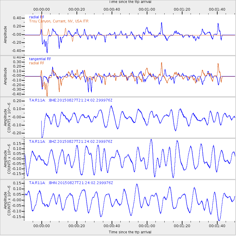
R11A Troy Canyon, Currant, NV, USA - Earthquake Result Viewer
*The percent match for this event was below the threshold and hence no stack was calculated.
| Earthquake location: |
Hokkaido, Japan Region |
| Earthquake latitude/longitude: |
42.4/142.6 |
| Earthquake time(UTC): |
2015/08/27 (239) 21:13:13 GMT |
| Earthquake Depth: |
77 km |
| Earthquake Magnitude: |
4.5 mb |
| Earthquake Catalog/Contributor: |
ISC/ISC |
|
| Network: |
TA USArray Transportable Network (new EarthScope stations) |
| Station: |
R11A Troy Canyon, Currant, NV, USA |
| Lat/Lon: |
38.35 N/115.59 W |
| Elevation: |
1756 m |
|
| Distance: |
72.8 deg |
| Az: |
53.696 deg |
| Baz: |
310.623 deg |
| Ray Param: |
$rayparam |
*The percent match for this event was below the threshold and hence was not used in the summary stack. |
|
| Radial Match: |
50.899944 % |
| Radial Bump: |
400 |
| Transverse Match: |
51.88576 % |
| Transverse Bump: |
400 |
| SOD ConfigId: |
7422571 |
| Insert Time: |
2019-04-20 15:04:58.908 +0000 |
| GWidth: |
2.5 |
| Max Bumps: |
400 |
| Tol: |
0.001 |
|
Signal To Noise
| Channel | StoN | STA | LTA |
| TA:R11A: :BHZ:20150827T21:24:02.299976Z | 0.3591725 | 3.5577866E-8 | 9.905509E-8 |
| TA:R11A: :BHN:20150827T21:24:02.299976Z | 1.346868 | 5.1515013E-8 | 3.8248E-8 |
| TA:R11A: :BHE:20150827T21:24:02.299976Z | 1.0324327 | 6.8810564E-8 | 6.6648965E-8 |
| Arrivals |
| Ps | |
| PpPs | |
| PsPs/PpSs | |


