You are here: Home > Network List > TA - USArray Transportable Network (new EarthScope stations) Stations List
> Station 833A Chaparral WMA, Artesia Wells, TX, USA > Earthquake Result Viewer
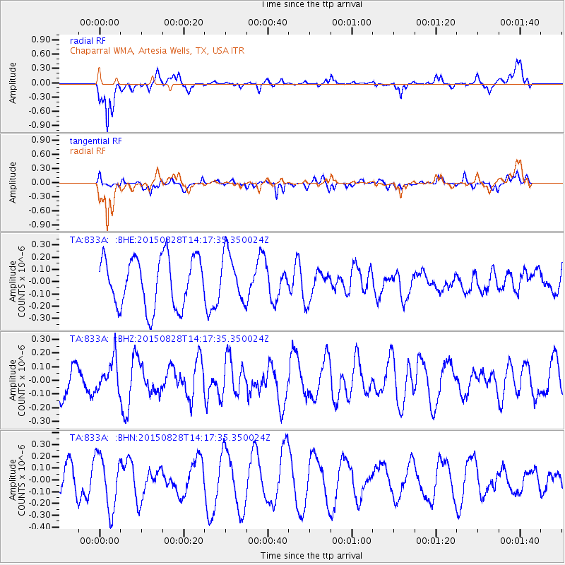
833A Chaparral WMA, Artesia Wells, TX, USA - Earthquake Result Viewer
*The percent match for this event was below the threshold and hence no stack was calculated.
| Earthquake location: |
Kermadec Islands Region |
| Earthquake latitude/longitude: |
-27.4/-176.2 |
| Earthquake time(UTC): |
2015/08/28 (240) 14:05:02 GMT |
| Earthquake Depth: |
49 km |
| Earthquake Magnitude: |
5.2 MW |
| Earthquake Catalog/Contributor: |
ISC/ISC |
|
| Network: |
TA USArray Transportable Network (new EarthScope stations) |
| Station: |
833A Chaparral WMA, Artesia Wells, TX, USA |
| Lat/Lon: |
28.32 N/99.39 W |
| Elevation: |
171 m |
|
| Distance: |
92.2 deg |
| Az: |
59.218 deg |
| Baz: |
240.007 deg |
| Ray Param: |
$rayparam |
*The percent match for this event was below the threshold and hence was not used in the summary stack. |
|
| Radial Match: |
70.57679 % |
| Radial Bump: |
400 |
| Transverse Match: |
59.8713 % |
| Transverse Bump: |
400 |
| SOD ConfigId: |
7422571 |
| Insert Time: |
2019-04-20 15:11:32.513 +0000 |
| GWidth: |
2.5 |
| Max Bumps: |
400 |
| Tol: |
0.001 |
|
Signal To Noise
| Channel | StoN | STA | LTA |
| TA:833A: :BHZ:20150828T14:17:35.350024Z | 1.0507153 | 1.204693E-7 | 1.14654554E-7 |
| TA:833A: :BHN:20150828T14:17:35.350024Z | 2.3526058 | 2.3014503E-7 | 9.782558E-8 |
| TA:833A: :BHE:20150828T14:17:35.350024Z | 0.9870679 | 2.00031E-7 | 2.0265172E-7 |
| Arrivals |
| Ps | |
| PpPs | |
| PsPs/PpSs | |


