You are here: Home > Network List > TA - USArray Transportable Network (new EarthScope stations) Stations List
> Station MSTX Muleshoe, TX, USA > Earthquake Result Viewer
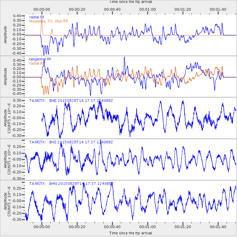
MSTX Muleshoe, TX, USA - Earthquake Result Viewer
*The percent match for this event was below the threshold and hence no stack was calculated.
| Earthquake location: |
Kermadec Islands Region |
| Earthquake latitude/longitude: |
-27.4/-176.2 |
| Earthquake time(UTC): |
2015/08/28 (240) 14:05:02 GMT |
| Earthquake Depth: |
49 km |
| Earthquake Magnitude: |
5.2 MW |
| Earthquake Catalog/Contributor: |
ISC/ISC |
|
| Network: |
TA USArray Transportable Network (new EarthScope stations) |
| Station: |
MSTX Muleshoe, TX, USA |
| Lat/Lon: |
33.97 N/102.77 W |
| Elevation: |
1167 m |
|
| Distance: |
92.6 deg |
| Az: |
52.895 deg |
| Baz: |
238.528 deg |
| Ray Param: |
$rayparam |
*The percent match for this event was below the threshold and hence was not used in the summary stack. |
|
| Radial Match: |
44.282215 % |
| Radial Bump: |
400 |
| Transverse Match: |
51.551712 % |
| Transverse Bump: |
400 |
| SOD ConfigId: |
7422571 |
| Insert Time: |
2019-04-20 15:11:43.900 +0000 |
| GWidth: |
2.5 |
| Max Bumps: |
400 |
| Tol: |
0.001 |
|
Signal To Noise
| Channel | StoN | STA | LTA |
| TA:MSTX: :BHZ:20150828T14:17:37.124988Z | 1.2410682 | 8.781373E-8 | 7.075656E-8 |
| TA:MSTX: :BHN:20150828T14:17:37.124988Z | 1.0451752 | 1.4986004E-7 | 1.4338269E-7 |
| TA:MSTX: :BHE:20150828T14:17:37.124988Z | 1.4302913 | 2.1165896E-7 | 1.4798312E-7 |
| Arrivals |
| Ps | |
| PpPs | |
| PsPs/PpSs | |


