You are here: Home > Network List > IW - Intermountain West Stations List
> Station MOOW Moose Ponds, Wyoming, USA > Earthquake Result Viewer
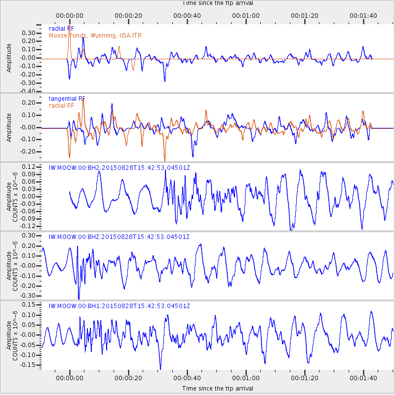
MOOW Moose Ponds, Wyoming, USA - Earthquake Result Viewer
*The percent match for this event was below the threshold and hence no stack was calculated.
| Earthquake location: |
Volcano Islands, Japan Region |
| Earthquake latitude/longitude: |
23.2/142.5 |
| Earthquake time(UTC): |
2015/08/28 (240) 15:30:59 GMT |
| Earthquake Depth: |
118 km |
| Earthquake Magnitude: |
5.3 MW |
| Earthquake Catalog/Contributor: |
ISC/ISC |
|
| Network: |
IW Intermountain West |
| Station: |
MOOW Moose Ponds, Wyoming, USA |
| Lat/Lon: |
43.75 N/110.74 W |
| Elevation: |
2128 m |
|
| Distance: |
85.6 deg |
| Az: |
44.097 deg |
| Baz: |
297.947 deg |
| Ray Param: |
$rayparam |
*The percent match for this event was below the threshold and hence was not used in the summary stack. |
|
| Radial Match: |
58.075005 % |
| Radial Bump: |
400 |
| Transverse Match: |
66.781944 % |
| Transverse Bump: |
400 |
| SOD ConfigId: |
7422571 |
| Insert Time: |
2019-04-20 15:16:44.007 +0000 |
| GWidth: |
2.5 |
| Max Bumps: |
400 |
| Tol: |
0.001 |
|
Signal To Noise
| Channel | StoN | STA | LTA |
| IW:MOOW:00:BHZ:20150828T15:42:53.04501Z | 2.3055546 | 1.471841E-7 | 6.383891E-8 |
| IW:MOOW:00:BH1:20150828T15:42:53.04501Z | 0.68446094 | 3.7865846E-8 | 5.5322143E-8 |
| IW:MOOW:00:BH2:20150828T15:42:53.04501Z | 1.208387 | 4.7437997E-8 | 3.9257287E-8 |
| Arrivals |
| Ps | |
| PpPs | |
| PsPs/PpSs | |


