You are here: Home > Network List > TA - USArray Transportable Network (new EarthScope stations) Stations List
> Station J20K Nowitna River, AK, USA > Earthquake Result Viewer
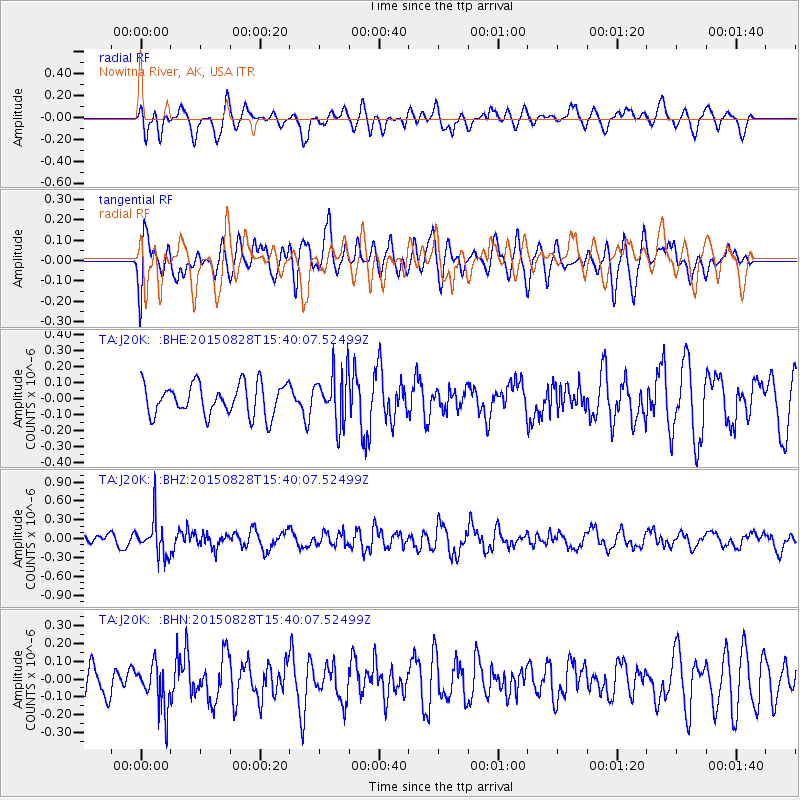
J20K Nowitna River, AK, USA - Earthquake Result Viewer
*The percent match for this event was below the threshold and hence no stack was calculated.
| Earthquake location: |
Volcano Islands, Japan Region |
| Earthquake latitude/longitude: |
23.2/142.5 |
| Earthquake time(UTC): |
2015/08/28 (240) 15:30:59 GMT |
| Earthquake Depth: |
118 km |
| Earthquake Magnitude: |
5.3 MW |
| Earthquake Catalog/Contributor: |
ISC/ISC |
|
| Network: |
TA USArray Transportable Network (new EarthScope stations) |
| Station: |
J20K Nowitna River, AK, USA |
| Lat/Lon: |
64.18 N/154.15 W |
| Elevation: |
314 m |
|
| Distance: |
57.8 deg |
| Az: |
27.565 deg |
| Baz: |
256.417 deg |
| Ray Param: |
$rayparam |
*The percent match for this event was below the threshold and hence was not used in the summary stack. |
|
| Radial Match: |
55.050694 % |
| Radial Bump: |
400 |
| Transverse Match: |
54.268543 % |
| Transverse Bump: |
400 |
| SOD ConfigId: |
7422571 |
| Insert Time: |
2019-04-20 15:18:16.101 +0000 |
| GWidth: |
2.5 |
| Max Bumps: |
400 |
| Tol: |
0.001 |
|
Signal To Noise
| Channel | StoN | STA | LTA |
| TA:J20K: :BHZ:20150828T15:40:07.52499Z | 2.3247674 | 2.952651E-7 | 1.2700845E-7 |
| TA:J20K: :BHN:20150828T15:40:07.52499Z | 1.0663344 | 1.2401246E-7 | 1.16297905E-7 |
| TA:J20K: :BHE:20150828T15:40:07.52499Z | 1.6304678 | 1.5787046E-7 | 9.6825254E-8 |
| Arrivals |
| Ps | |
| PpPs | |
| PsPs/PpSs | |


