You are here: Home > Network List > US - United States National Seismic Network Stations List
> Station LAO LASA Array, Montana, USA > Earthquake Result Viewer
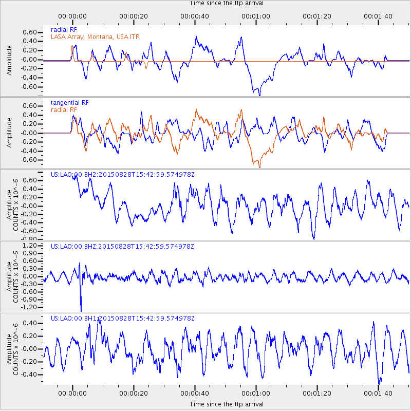
LAO LASA Array, Montana, USA - Earthquake Result Viewer
*The percent match for this event was below the threshold and hence no stack was calculated.
| Earthquake location: |
Volcano Islands, Japan Region |
| Earthquake latitude/longitude: |
23.2/142.5 |
| Earthquake time(UTC): |
2015/08/28 (240) 15:30:59 GMT |
| Earthquake Depth: |
118 km |
| Earthquake Magnitude: |
5.3 MW |
| Earthquake Catalog/Contributor: |
ISC/ISC |
|
| Network: |
US United States National Seismic Network |
| Station: |
LAO LASA Array, Montana, USA |
| Lat/Lon: |
46.69 N/106.22 W |
| Elevation: |
902 m |
|
| Distance: |
86.9 deg |
| Az: |
39.959 deg |
| Baz: |
300.875 deg |
| Ray Param: |
$rayparam |
*The percent match for this event was below the threshold and hence was not used in the summary stack. |
|
| Radial Match: |
35.620346 % |
| Radial Bump: |
400 |
| Transverse Match: |
55.535076 % |
| Transverse Bump: |
400 |
| SOD ConfigId: |
7422571 |
| Insert Time: |
2019-04-20 15:18:58.146 +0000 |
| GWidth: |
2.5 |
| Max Bumps: |
400 |
| Tol: |
0.001 |
|
Signal To Noise
| Channel | StoN | STA | LTA |
| US:LAO:00:BHZ:20150828T15:42:59.574978Z | 2.918743 | 3.8552676E-7 | 1.3208658E-7 |
| US:LAO:00:BH1:20150828T15:42:59.574978Z | 0.6216634 | 1.4559872E-7 | 2.3420829E-7 |
| US:LAO:00:BH2:20150828T15:42:59.574978Z | 0.83603555 | 2.804363E-7 | 3.3543586E-7 |
| Arrivals |
| Ps | |
| PpPs | |
| PsPs/PpSs | |


