You are here: Home > Network List > US - United States National Seismic Network Stations List
> Station HAWA Hanford, Washington, USA > Earthquake Result Viewer
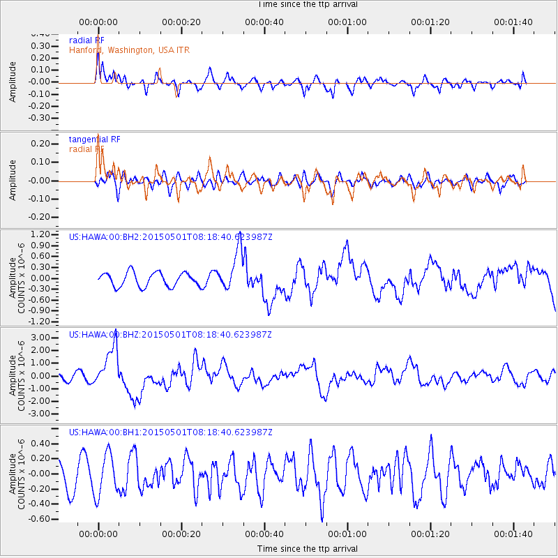
HAWA Hanford, Washington, USA - Earthquake Result Viewer
*The percent match for this event was below the threshold and hence no stack was calculated.
| Earthquake location: |
New Britain Region, P.N.G. |
| Earthquake latitude/longitude: |
-5.2/151.8 |
| Earthquake time(UTC): |
2015/05/01 (121) 08:06:05 GMT |
| Earthquake Depth: |
54 km |
| Earthquake Magnitude: |
7.1 MO |
| Earthquake Catalog/Contributor: |
NEIC PDE/NEIC ALERT |
|
| Network: |
US United States National Seismic Network |
| Station: |
HAWA Hanford, Washington, USA |
| Lat/Lon: |
46.39 N/119.53 W |
| Elevation: |
364 m |
|
| Distance: |
92.8 deg |
| Az: |
43.853 deg |
| Baz: |
265.469 deg |
| Ray Param: |
$rayparam |
*The percent match for this event was below the threshold and hence was not used in the summary stack. |
|
| Radial Match: |
75.67786 % |
| Radial Bump: |
400 |
| Transverse Match: |
44.289806 % |
| Transverse Bump: |
400 |
| SOD ConfigId: |
872571 |
| Insert Time: |
2015-05-15 14:10:45.348 +0000 |
| GWidth: |
2.5 |
| Max Bumps: |
400 |
| Tol: |
0.001 |
|
Signal To Noise
| Channel | StoN | STA | LTA |
| US:HAWA:00:BHZ:20150501T08:18:40.623987Z | 6.9292774 | 1.7103231E-6 | 2.468256E-7 |
| US:HAWA:00:BH1:20150501T08:18:40.623987Z | 1.9118134 | 2.775515E-7 | 1.451771E-7 |
| US:HAWA:00:BH2:20150501T08:18:40.623987Z | 3.0295615 | 5.836797E-7 | 1.9266146E-7 |
| Arrivals |
| Ps | |
| PpPs | |
| PsPs/PpSs | |


