You are here: Home > Network List > IU - Global Seismograph Network (GSN - IRIS/USGS) Stations List
> Station CTAO Charters Towers, Australia > Earthquake Result Viewer
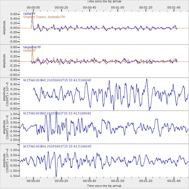
CTAO Charters Towers, Australia - Earthquake Result Viewer
*The percent match for this event was below the threshold and hence no stack was calculated.
| Earthquake location: |
Southeast Of Honshu, Japan |
| Earthquake latitude/longitude: |
31.2/141.6 |
| Earthquake time(UTC): |
2015/09/01 (244) 15:25:10 GMT |
| Earthquake Depth: |
13 km |
| Earthquake Magnitude: |
5.6 MB |
| Earthquake Catalog/Contributor: |
NEIC PDE/NEIC COMCAT |
|
| Network: |
IU Global Seismograph Network (GSN - IRIS/USGS) |
| Station: |
CTAO Charters Towers, Australia |
| Lat/Lon: |
20.09 S/146.25 E |
| Elevation: |
357 m |
|
| Distance: |
51.1 deg |
| Az: |
174.365 deg |
| Baz: |
354.862 deg |
| Ray Param: |
$rayparam |
*The percent match for this event was below the threshold and hence was not used in the summary stack. |
|
| Radial Match: |
72.66358 % |
| Radial Bump: |
297 |
| Transverse Match: |
59.55888 % |
| Transverse Bump: |
353 |
| SOD ConfigId: |
7422571 |
| Insert Time: |
2019-04-20 15:55:32.959 +0000 |
| GWidth: |
2.5 |
| Max Bumps: |
400 |
| Tol: |
0.001 |
|
Signal To Noise
| Channel | StoN | STA | LTA |
| IU:CTAO:00:BHZ:20150901T15:33:41.519004Z | 1.6066313 | 3.646292E-7 | 2.2695264E-7 |
| IU:CTAO:00:BH1:20150901T15:33:41.519004Z | 1.8519247 | 3.107797E-7 | 1.6781445E-7 |
| IU:CTAO:00:BH2:20150901T15:33:41.519004Z | 1.21423 | 1.7556422E-7 | 1.4458895E-7 |
| Arrivals |
| Ps | |
| PpPs | |
| PsPs/PpSs | |


