You are here: Home > Network List > KN - Kyrgyz Seismic Telemetry Network Stations List
> Station TKM2 - > Earthquake Result Viewer
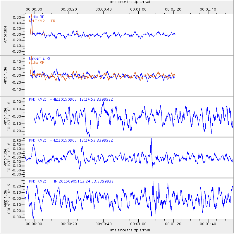
TKM2 - - Earthquake Result Viewer
*The percent match for this event was below the threshold and hence no stack was calculated.
| Earthquake location: |
Kuril Islands |
| Earthquake latitude/longitude: |
49.4/155.6 |
| Earthquake time(UTC): |
2015/09/05 (248) 13:16:10 GMT |
| Earthquake Depth: |
47 km |
| Earthquake Magnitude: |
5.9 MWB |
| Earthquake Catalog/Contributor: |
NEIC PDE/NEIC COMCAT |
|
| Network: |
KN Kyrgyz Seismic Telemetry Network |
| Station: |
TKM2 - |
| Lat/Lon: |
42.92 N/75.60 E |
| Elevation: |
2020 m |
|
| Distance: |
53.4 deg |
| Az: |
295.66 deg |
| Baz: |
53.358 deg |
| Ray Param: |
$rayparam |
*The percent match for this event was below the threshold and hence was not used in the summary stack. |
|
| Radial Match: |
74.48923 % |
| Radial Bump: |
400 |
| Transverse Match: |
62.467182 % |
| Transverse Bump: |
400 |
| SOD ConfigId: |
7422571 |
| Insert Time: |
2019-04-20 16:07:41.440 +0000 |
| GWidth: |
2.5 |
| Max Bumps: |
400 |
| Tol: |
0.001 |
|
Signal To Noise
| Channel | StoN | STA | LTA |
| KN:TKM2: :HHZ:20150905T13:24:53.339993Z | 5.7235546 | 3.093249E-7 | 5.4044193E-8 |
| KN:TKM2: :HHN:20150905T13:24:53.339993Z | 2.1602395 | 1.5966032E-7 | 7.390862E-8 |
| KN:TKM2: :HHE:20150905T13:24:53.339993Z | 2.5903957 | 1.4748693E-7 | 5.6936063E-8 |
| Arrivals |
| Ps | |
| PpPs | |
| PsPs/PpSs | |


