You are here: Home > Network List > TA - USArray Transportable Network (new EarthScope stations) Stations List
> Station J61A Chester, VT, USA > Earthquake Result Viewer
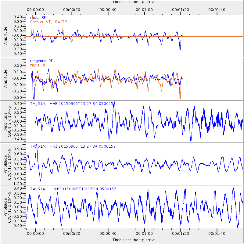
J61A Chester, VT, USA - Earthquake Result Viewer
*The percent match for this event was below the threshold and hence no stack was calculated.
| Earthquake location: |
Kuril Islands |
| Earthquake latitude/longitude: |
49.4/155.6 |
| Earthquake time(UTC): |
2015/09/05 (248) 13:16:10 GMT |
| Earthquake Depth: |
47 km |
| Earthquake Magnitude: |
5.9 MWB |
| Earthquake Catalog/Contributor: |
NEIC PDE/NEIC COMCAT |
|
| Network: |
TA USArray Transportable Network (new EarthScope stations) |
| Station: |
J61A Chester, VT, USA |
| Lat/Lon: |
43.35 N/72.55 W |
| Elevation: |
253 m |
|
| Distance: |
78.5 deg |
| Az: |
33.705 deg |
| Baz: |
330.172 deg |
| Ray Param: |
$rayparam |
*The percent match for this event was below the threshold and hence was not used in the summary stack. |
|
| Radial Match: |
70.90483 % |
| Radial Bump: |
400 |
| Transverse Match: |
58.60524 % |
| Transverse Bump: |
400 |
| SOD ConfigId: |
7422571 |
| Insert Time: |
2019-04-20 16:13:45.291 +0000 |
| GWidth: |
2.5 |
| Max Bumps: |
400 |
| Tol: |
0.001 |
|
Signal To Noise
| Channel | StoN | STA | LTA |
| TA:J61A: :HHZ:20150905T13:27:34.050015Z | 3.4205277 | 5.9714176E-7 | 1.7457592E-7 |
| TA:J61A: :HHN:20150905T13:27:34.050015Z | 0.83594644 | 1.9676905E-7 | 2.3538476E-7 |
| TA:J61A: :HHE:20150905T13:27:34.050015Z | 1.0234226 | 1.07418224E-7 | 1.04959796E-7 |
| Arrivals |
| Ps | |
| PpPs | |
| PsPs/PpSs | |


