You are here: Home > Network List > TA - USArray Transportable Network (new EarthScope stations) Stations List
> Station K61A Williamstown, MA, USA > Earthquake Result Viewer
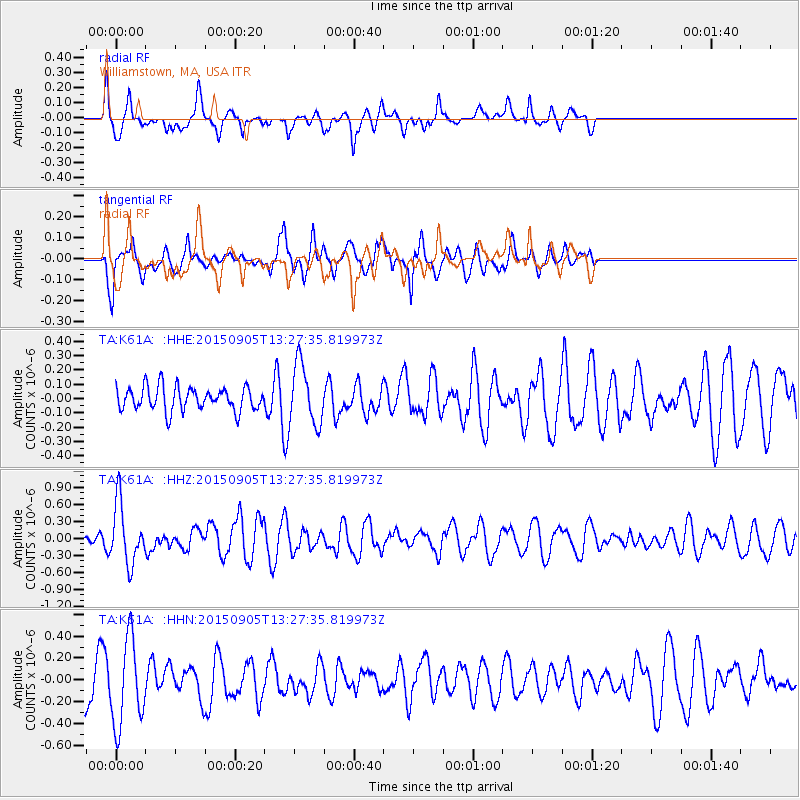
K61A Williamstown, MA, USA - Earthquake Result Viewer
*The percent match for this event was below the threshold and hence no stack was calculated.
| Earthquake location: |
Kuril Islands |
| Earthquake latitude/longitude: |
49.4/155.6 |
| Earthquake time(UTC): |
2015/09/05 (248) 13:16:10 GMT |
| Earthquake Depth: |
47 km |
| Earthquake Magnitude: |
5.9 MWB |
| Earthquake Catalog/Contributor: |
NEIC PDE/NEIC COMCAT |
|
| Network: |
TA USArray Transportable Network (new EarthScope stations) |
| Station: |
K61A Williamstown, MA, USA |
| Lat/Lon: |
42.67 N/73.27 W |
| Elevation: |
391 m |
|
| Distance: |
78.8 deg |
| Az: |
34.513 deg |
| Baz: |
329.846 deg |
| Ray Param: |
$rayparam |
*The percent match for this event was below the threshold and hence was not used in the summary stack. |
|
| Radial Match: |
62.157455 % |
| Radial Bump: |
291 |
| Transverse Match: |
60.834854 % |
| Transverse Bump: |
373 |
| SOD ConfigId: |
7422571 |
| Insert Time: |
2019-04-20 16:13:50.136 +0000 |
| GWidth: |
2.5 |
| Max Bumps: |
400 |
| Tol: |
0.001 |
|
Signal To Noise
| Channel | StoN | STA | LTA |
| TA:K61A: :HHZ:20150905T13:27:35.819973Z | 3.9107997 | 5.2831274E-7 | 1.3509072E-7 |
| TA:K61A: :HHN:20150905T13:27:35.819973Z | 2.6025486 | 3.973847E-7 | 1.526906E-7 |
| TA:K61A: :HHE:20150905T13:27:35.819973Z | 2.4351246 | 2.0248987E-7 | 8.31538E-8 |
| Arrivals |
| Ps | |
| PpPs | |
| PsPs/PpSs | |


