You are here: Home > Network List > TA - USArray Transportable Network (new EarthScope stations) Stations List
> Station W41B Gary Mavity, Velonia, AR, USA > Earthquake Result Viewer
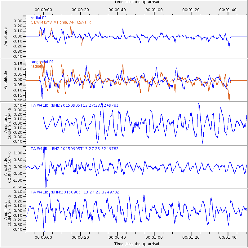
W41B Gary Mavity, Velonia, AR, USA - Earthquake Result Viewer
*The percent match for this event was below the threshold and hence no stack was calculated.
| Earthquake location: |
Kuril Islands |
| Earthquake latitude/longitude: |
49.4/155.6 |
| Earthquake time(UTC): |
2015/09/05 (248) 13:16:10 GMT |
| Earthquake Depth: |
47 km |
| Earthquake Magnitude: |
5.9 MWB |
| Earthquake Catalog/Contributor: |
NEIC PDE/NEIC COMCAT |
|
| Network: |
TA USArray Transportable Network (new EarthScope stations) |
| Station: |
W41B Gary Mavity, Velonia, AR, USA |
| Lat/Lon: |
35.17 N/92.25 W |
| Elevation: |
95 m |
|
| Distance: |
76.6 deg |
| Az: |
51.287 deg |
| Baz: |
321.478 deg |
| Ray Param: |
$rayparam |
*The percent match for this event was below the threshold and hence was not used in the summary stack. |
|
| Radial Match: |
59.508224 % |
| Radial Bump: |
372 |
| Transverse Match: |
62.429306 % |
| Transverse Bump: |
391 |
| SOD ConfigId: |
7422571 |
| Insert Time: |
2019-04-20 16:14:23.293 +0000 |
| GWidth: |
2.5 |
| Max Bumps: |
400 |
| Tol: |
0.001 |
|
Signal To Noise
| Channel | StoN | STA | LTA |
| TA:W41B: :BHZ:20150905T13:27:23.324978Z | 5.159075 | 7.9792875E-7 | 1.5466509E-7 |
| TA:W41B: :BHN:20150905T13:27:23.324978Z | 1.415182 | 2.0470604E-7 | 1.4464997E-7 |
| TA:W41B: :BHE:20150905T13:27:23.324978Z | 2.414611 | 2.5274474E-7 | 1.0467307E-7 |
| Arrivals |
| Ps | |
| PpPs | |
| PsPs/PpSs | |


