You are here: Home > Network List > IU - Global Seismograph Network (GSN - IRIS/USGS) Stations List
> Station JOHN Johnston Island, USA > Earthquake Result Viewer
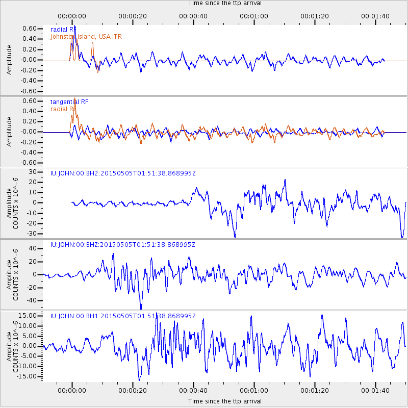
JOHN Johnston Island, USA - Earthquake Result Viewer

| Earthquake location: |
New Britain Region, P.N.G. |
| Earthquake latitude/longitude: |
-5.5/151.9 |
| Earthquake time(UTC): |
2015/05/05 (125) 01:44:07 GMT |
| Earthquake Depth: |
63 km |
| Earthquake Magnitude: |
7.4 MWW, 7.5 MI |
| Earthquake Catalog/Contributor: |
NEIC PDE/NEIC COMCAT |
|
| Network: |
IU Global Seismograph Network (GSN - IRIS/USGS) |
| Station: |
JOHN Johnston Island, USA |
| Lat/Lon: |
16.73 N/169.53 W |
| Elevation: |
2.0 m |
|
| Distance: |
44.1 deg |
| Az: |
59.185 deg |
| Baz: |
243.154 deg |
| Ray Param: |
0.071967974 |
| Estimated Moho Depth: |
11.5 km |
| Estimated Crust Vp/Vs: |
1.70 |
| Assumed Crust Vp: |
4.24 km/s |
| Estimated Crust Vs: |
2.494 km/s |
| Estimated Crust Poisson's Ratio: |
0.24 |
|
| Radial Match: |
90.908356 % |
| Radial Bump: |
390 |
| Transverse Match: |
81.17826 % |
| Transverse Bump: |
400 |
| SOD ConfigId: |
872571 |
| Insert Time: |
2015-05-19 02:12:10.766 +0000 |
| GWidth: |
2.5 |
| Max Bumps: |
400 |
| Tol: |
0.001 |
|
Signal To Noise
| Channel | StoN | STA | LTA |
| IU:JOHN:00:BHZ:20150505T01:51:38.868995Z | 2.5541515 | 3.7213097E-6 | 1.4569652E-6 |
| IU:JOHN:00:BH1:20150505T01:51:38.868995Z | 1.3940338 | 2.1854712E-6 | 1.5677319E-6 |
| IU:JOHN:00:BH2:20150505T01:51:38.868995Z | 1.1469873 | 1.5587581E-6 | 1.359002E-6 |
| Arrivals |
| Ps | 2.0 SECOND |
| PpPs | 7.1 SECOND |
| PsPs/PpSs | 9.1 SECOND |


