You are here: Home > Network List > TA - USArray Transportable Network (new EarthScope stations) Stations List
> Station X43A Marvell, AR, USA > Earthquake Result Viewer
X43A Marvell, AR, USA - Earthquake Result Viewer
*The percent match for this event was below the threshold and hence no stack was calculated.
| Earthquake location: |
Eastern Caucasus |
| Earthquake latitude/longitude: |
40.9/47.5 |
| Earthquake time(UTC): |
2015/09/04 (247) 04:49:38 GMT |
| Earthquake Depth: |
14 km |
| Earthquake Magnitude: |
5.4 mww |
| Earthquake Catalog/Contributor: |
NEIC PDE/us |
|
| Network: |
TA USArray Transportable Network (new EarthScope stations) |
| Station: |
X43A Marvell, AR, USA |
| Lat/Lon: |
34.52 N/90.88 W |
| Elevation: |
53 m |
|
| Distance: |
95.7 deg |
| Az: |
326.577 deg |
| Baz: |
30.358 deg |
| Ray Param: |
$rayparam |
*The percent match for this event was below the threshold and hence was not used in the summary stack. |
|
| Radial Match: |
48.99929 % |
| Radial Bump: |
374 |
| Transverse Match: |
45.071663 % |
| Transverse Bump: |
373 |
| SOD ConfigId: |
7422571 |
| Insert Time: |
2019-04-20 16:39:10.912 +0000 |
| GWidth: |
2.5 |
| Max Bumps: |
400 |
| Tol: |
0.001 |
|
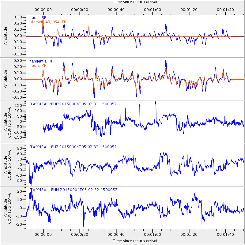
Signal To Noise
| Channel | StoN | STA | LTA |
| TA:X43A: :BHZ:20150904T05:02:32.150005Z | 0.60418874 | 1.7824636E-5 | 2.9501767E-5 |
| TA:X43A: :BHN:20150904T05:02:32.150005Z | 1.1732196 | 9.08603E-6 | 7.7445275E-6 |
| TA:X43A: :BHE:20150904T05:02:32.150005Z | 1.6347957 | 8.7713255E-5 | 5.3653956E-5 |
| Arrivals |
| Ps | |
| PpPs | |
| PsPs/PpSs | |


