You are here: Home > Network List > TA - USArray Transportable Network (new EarthScope stations) Stations List
> Station Z41A Richland Creek Farm, El Dorado, AR, USA > Earthquake Result Viewer
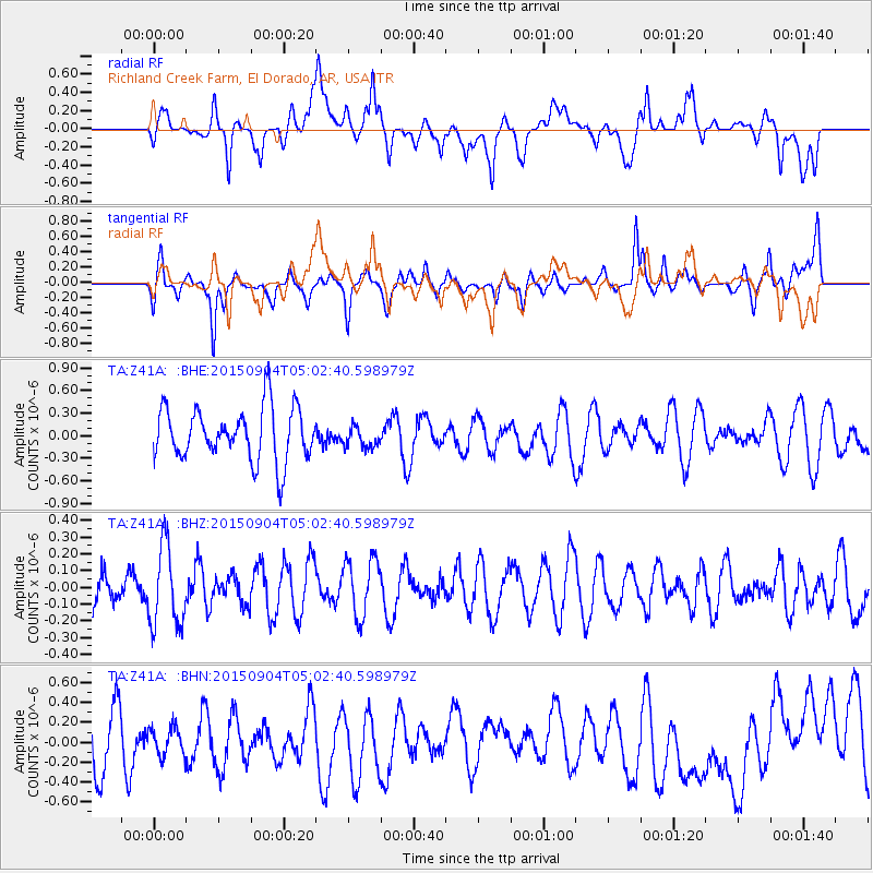
Z41A Richland Creek Farm, El Dorado, AR, USA - Earthquake Result Viewer
*The percent match for this event was below the threshold and hence no stack was calculated.
| Earthquake location: |
Eastern Caucasus |
| Earthquake latitude/longitude: |
40.9/47.5 |
| Earthquake time(UTC): |
2015/09/04 (247) 04:49:38 GMT |
| Earthquake Depth: |
14 km |
| Earthquake Magnitude: |
5.4 mww |
| Earthquake Catalog/Contributor: |
NEIC PDE/us |
|
| Network: |
TA USArray Transportable Network (new EarthScope stations) |
| Station: |
Z41A Richland Creek Farm, El Dorado, AR, USA |
| Lat/Lon: |
33.26 N/92.80 W |
| Elevation: |
62 m |
|
| Distance: |
97.6 deg |
| Az: |
327.346 deg |
| Baz: |
29.202 deg |
| Ray Param: |
$rayparam |
*The percent match for this event was below the threshold and hence was not used in the summary stack. |
|
| Radial Match: |
39.190388 % |
| Radial Bump: |
400 |
| Transverse Match: |
59.751156 % |
| Transverse Bump: |
365 |
| SOD ConfigId: |
7422571 |
| Insert Time: |
2019-04-20 16:39:10.955 +0000 |
| GWidth: |
2.5 |
| Max Bumps: |
400 |
| Tol: |
0.001 |
|
Signal To Noise
| Channel | StoN | STA | LTA |
| TA:Z41A: :BHZ:20150904T05:02:40.598979Z | 2.4732556 | 2.4039514E-7 | 9.719786E-8 |
| TA:Z41A: :BHN:20150904T05:02:40.598979Z | 0.4346711 | 1.4470739E-7 | 3.3291235E-7 |
| TA:Z41A: :BHE:20150904T05:02:40.598979Z | 0.40775242 | 1.4198312E-7 | 3.4820914E-7 |
| Arrivals |
| Ps | |
| PpPs | |
| PsPs/PpSs | |


