You are here: Home > Network List > GS - US Geological Survey Networks Stations List
> Station KAN10 Keim Farm > Earthquake Result Viewer
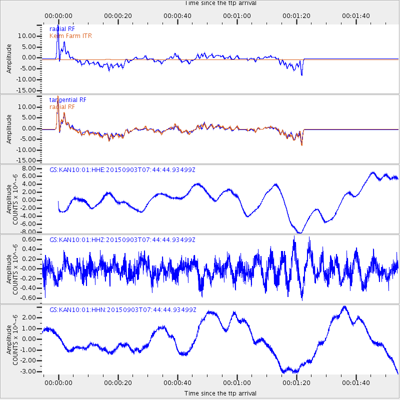
KAN10 Keim Farm - Earthquake Result Viewer
*The percent match for this event was below the threshold and hence no stack was calculated.
| Earthquake location: |
Tonga Islands |
| Earthquake latitude/longitude: |
-15.5/-174.7 |
| Earthquake time(UTC): |
2015/09/03 (246) 07:32:46 GMT |
| Earthquake Depth: |
212 km |
| Earthquake Magnitude: |
5.2 mb |
| Earthquake Catalog/Contributor: |
NEIC PDE/us |
|
| Network: |
GS US Geological Survey Networks |
| Station: |
KAN10 Keim Farm |
| Lat/Lon: |
37.12 N/98.10 W |
| Elevation: |
417 m |
|
| Distance: |
88.9 deg |
| Az: |
51.05 deg |
| Baz: |
249.747 deg |
| Ray Param: |
$rayparam |
*The percent match for this event was below the threshold and hence was not used in the summary stack. |
|
| Radial Match: |
44.106228 % |
| Radial Bump: |
400 |
| Transverse Match: |
41.40669 % |
| Transverse Bump: |
400 |
| SOD ConfigId: |
7422571 |
| Insert Time: |
2019-04-20 16:47:56.817 +0000 |
| GWidth: |
2.5 |
| Max Bumps: |
400 |
| Tol: |
0.001 |
|
Signal To Noise
| Channel | StoN | STA | LTA |
| GS:KAN10:01:HHZ:20150903T07:44:44.93499Z | 0.95937234 | 1.6858523E-7 | 1.7572451E-7 |
| GS:KAN10:01:HHN:20150903T07:44:44.93499Z | 1.6613275 | 8.857316E-7 | 5.3314693E-7 |
| GS:KAN10:01:HHE:20150903T07:44:44.93499Z | 1.2579912 | 1.5687563E-6 | 1.2470327E-6 |
| Arrivals |
| Ps | |
| PpPs | |
| PsPs/PpSs | |


