You are here: Home > Network List > TA - USArray Transportable Network (new EarthScope stations) Stations List
> Station I23K Minto, Yukon-Koyukuk, AK, USA > Earthquake Result Viewer
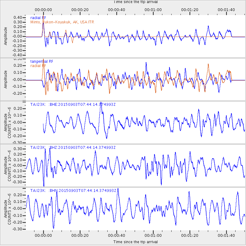
I23K Minto, Yukon-Koyukuk, AK, USA - Earthquake Result Viewer
*The percent match for this event was below the threshold and hence no stack was calculated.
| Earthquake location: |
Tonga Islands |
| Earthquake latitude/longitude: |
-15.5/-174.7 |
| Earthquake time(UTC): |
2015/09/03 (246) 07:32:46 GMT |
| Earthquake Depth: |
212 km |
| Earthquake Magnitude: |
5.2 mb |
| Earthquake Catalog/Contributor: |
NEIC PDE/us |
|
| Network: |
TA USArray Transportable Network (new EarthScope stations) |
| Station: |
I23K Minto, Yukon-Koyukuk, AK, USA |
| Lat/Lon: |
65.15 N/149.36 W |
| Elevation: |
149 m |
|
| Distance: |
82.6 deg |
| Az: |
10.51 deg |
| Baz: |
204.593 deg |
| Ray Param: |
$rayparam |
*The percent match for this event was below the threshold and hence was not used in the summary stack. |
|
| Radial Match: |
52.942112 % |
| Radial Bump: |
400 |
| Transverse Match: |
48.05399 % |
| Transverse Bump: |
400 |
| SOD ConfigId: |
7422571 |
| Insert Time: |
2019-04-20 16:50:24.214 +0000 |
| GWidth: |
2.5 |
| Max Bumps: |
400 |
| Tol: |
0.001 |
|
Signal To Noise
| Channel | StoN | STA | LTA |
| TA:I23K: :BHZ:20150903T07:44:14.374993Z | 1.6933521 | 1.7946898E-7 | 1.0598444E-7 |
| TA:I23K: :BHN:20150903T07:44:14.374993Z | 0.6797944 | 8.321837E-8 | 1.2241698E-7 |
| TA:I23K: :BHE:20150903T07:44:14.374993Z | 1.9695414 | 1.6718175E-7 | 8.4883595E-8 |
| Arrivals |
| Ps | |
| PpPs | |
| PsPs/PpSs | |


