You are here: Home > Network List > UW - Pacific Northwest Regional Seismic Network Stations List
> Station LEBA Lebam, WA, USA > Earthquake Result Viewer
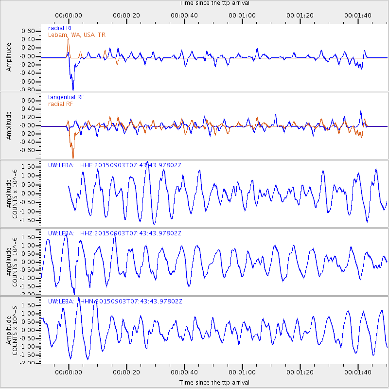
LEBA Lebam, WA, USA - Earthquake Result Viewer
*The percent match for this event was below the threshold and hence no stack was calculated.
| Earthquake location: |
Tonga Islands |
| Earthquake latitude/longitude: |
-15.5/-174.7 |
| Earthquake time(UTC): |
2015/09/03 (246) 07:32:46 GMT |
| Earthquake Depth: |
212 km |
| Earthquake Magnitude: |
5.2 mb |
| Earthquake Catalog/Contributor: |
NEIC PDE/us |
|
| Network: |
UW Pacific Northwest Regional Seismic Network |
| Station: |
LEBA Lebam, WA, USA |
| Lat/Lon: |
46.55 N/123.56 W |
| Elevation: |
73 m |
|
| Distance: |
77.0 deg |
| Az: |
33.483 deg |
| Baz: |
230.418 deg |
| Ray Param: |
$rayparam |
*The percent match for this event was below the threshold and hence was not used in the summary stack. |
|
| Radial Match: |
80.58483 % |
| Radial Bump: |
400 |
| Transverse Match: |
70.63605 % |
| Transverse Bump: |
400 |
| SOD ConfigId: |
7422571 |
| Insert Time: |
2019-04-20 16:51:32.744 +0000 |
| GWidth: |
2.5 |
| Max Bumps: |
400 |
| Tol: |
0.001 |
|
Signal To Noise
| Channel | StoN | STA | LTA |
| UW:LEBA: :HHZ:20150903T07:43:43.97802Z | 1.1364682 | 1.1919625E-6 | 1.0488305E-6 |
| UW:LEBA: :HHN:20150903T07:43:43.97802Z | 2.2919183 | 1.1813519E-6 | 5.154424E-7 |
| UW:LEBA: :HHE:20150903T07:43:43.97802Z | 1.3482448 | 1.0271299E-6 | 7.6182744E-7 |
| Arrivals |
| Ps | |
| PpPs | |
| PsPs/PpSs | |


