You are here: Home > Network List > IU - Global Seismograph Network (GSN - IRIS/USGS) Stations List
> Station JOHN Johnston Island, USA > Earthquake Result Viewer
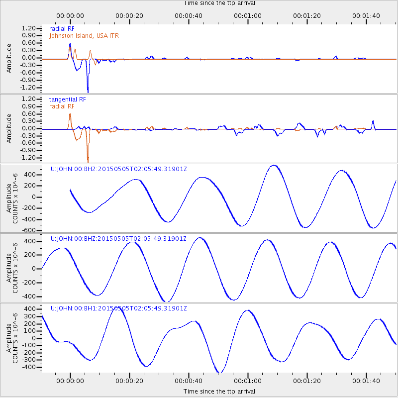
JOHN Johnston Island, USA - Earthquake Result Viewer
*The percent match for this event was below the threshold and hence no stack was calculated.
| Earthquake location: |
New Britain Region, P.N.G. |
| Earthquake latitude/longitude: |
-5.3/152.2 |
| Earthquake time(UTC): |
2015/05/05 (125) 01:58:20 GMT |
| Earthquake Depth: |
58 km |
| Earthquake Magnitude: |
5.6 MB |
| Earthquake Catalog/Contributor: |
NEIC PDE/NEIC COMCAT |
|
| Network: |
IU Global Seismograph Network (GSN - IRIS/USGS) |
| Station: |
JOHN Johnston Island, USA |
| Lat/Lon: |
16.73 N/169.53 W |
| Elevation: |
2.0 m |
|
| Distance: |
43.7 deg |
| Az: |
59.219 deg |
| Baz: |
243.234 deg |
| Ray Param: |
$rayparam |
*The percent match for this event was below the threshold and hence was not used in the summary stack. |
|
| Radial Match: |
97.48376 % |
| Radial Bump: |
268 |
| Transverse Match: |
70.01523 % |
| Transverse Bump: |
400 |
| SOD ConfigId: |
872571 |
| Insert Time: |
2015-05-19 02:20:28.618 +0000 |
| GWidth: |
2.5 |
| Max Bumps: |
400 |
| Tol: |
0.001 |
|
Signal To Noise
| Channel | StoN | STA | LTA |
| IU:JOHN:00:BHZ:20150505T02:05:49.31901Z | 0.8832018 | 1.6347646E-4 | 1.8509525E-4 |
| IU:JOHN:00:BH1:20150505T02:05:49.31901Z | 0.70005333 | 1.7474826E-4 | 2.4962137E-4 |
| IU:JOHN:00:BH2:20150505T02:05:49.31901Z | 1.9612635 | 4.0152972E-4 | 2.0473012E-4 |
| Arrivals |
| Ps | |
| PpPs | |
| PsPs/PpSs | |


