You are here: Home > Network List > US - United States National Seismic Network Stations List
> Station HAWA Hanford, Washington, USA > Earthquake Result Viewer
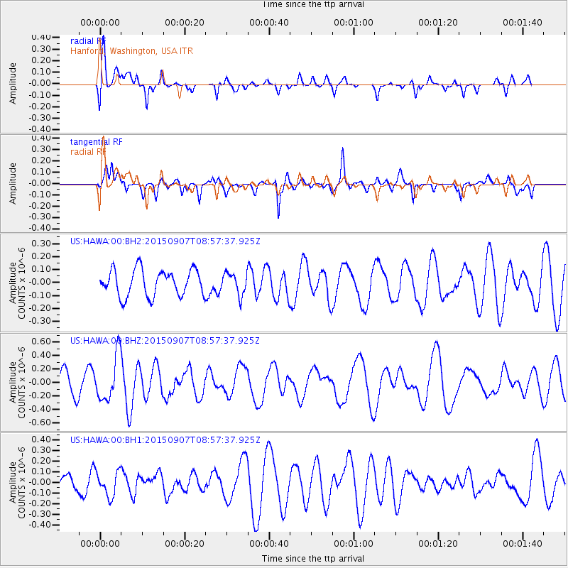
HAWA Hanford, Washington, USA - Earthquake Result Viewer
*The percent match for this event was below the threshold and hence no stack was calculated.
| Earthquake location: |
South Of Fiji Islands |
| Earthquake latitude/longitude: |
-24.2/179.1 |
| Earthquake time(UTC): |
2015/09/07 (250) 08:46:09 GMT |
| Earthquake Depth: |
535 km |
| Earthquake Magnitude: |
6.0 mww |
| Earthquake Catalog/Contributor: |
NEIC PDE/us |
|
| Network: |
US United States National Seismic Network |
| Station: |
HAWA Hanford, Washington, USA |
| Lat/Lon: |
46.39 N/119.53 W |
| Elevation: |
364 m |
|
| Distance: |
89.5 deg |
| Az: |
37.399 deg |
| Baz: |
233.228 deg |
| Ray Param: |
$rayparam |
*The percent match for this event was below the threshold and hence was not used in the summary stack. |
|
| Radial Match: |
57.30832 % |
| Radial Bump: |
400 |
| Transverse Match: |
48.851616 % |
| Transverse Bump: |
400 |
| SOD ConfigId: |
7422571 |
| Insert Time: |
2019-04-20 17:10:17.522 +0000 |
| GWidth: |
2.5 |
| Max Bumps: |
400 |
| Tol: |
0.001 |
|
Signal To Noise
| Channel | StoN | STA | LTA |
| US:HAWA:00:BHZ:20150907T08:57:37.925Z | 2.6736739 | 3.447543E-7 | 1.2894404E-7 |
| US:HAWA:00:BH1:20150907T08:57:37.925Z | 1.4470775 | 1.15910765E-7 | 8.00999E-8 |
| US:HAWA:00:BH2:20150907T08:57:37.925Z | 0.847875 | 8.564285E-8 | 1.01008816E-7 |
| Arrivals |
| Ps | |
| PpPs | |
| PsPs/PpSs | |


