
CHTO Chiang Mai, Thailand - Earthquake Result Viewer
| ||||||||||||||||||
| ||||||||||||||||||
| ||||||||||||||||||
|
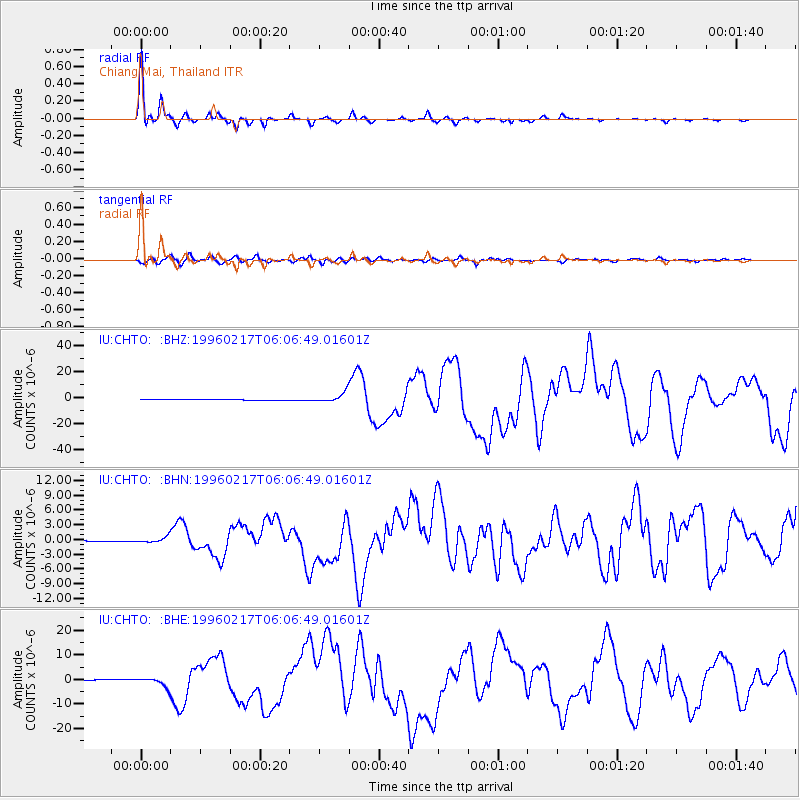
Signal To Noise
| Channel | StoN | STA | LTA |
| IU:CHTO: :BHN:19960217T06:06:49.01601Z | 7.0663204 | 5.649806E-7 | 7.995401E-8 |
| IU:CHTO: :BHE:19960217T06:06:49.01601Z | 10.999546 | 1.8074761E-6 | 1.6432278E-7 |
| IU:CHTO: :BHZ:19960217T06:06:49.01601Z | 18.972433 | 3.6984397E-6 | 1.9493756E-7 |
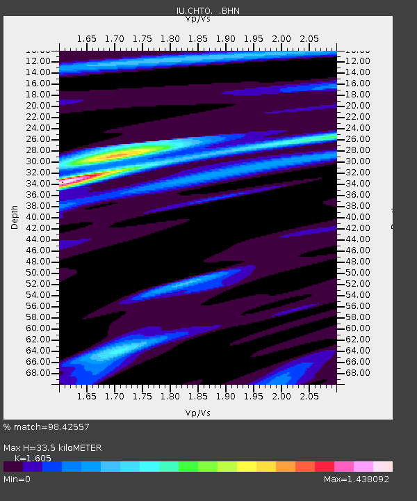
| Arrivals | |
| Ps | 3.4 SECOND |
| PpPs | 13 SECOND |
| PsPs/PpSs | 16 SECOND |

